
Photographer’s
Introduction to
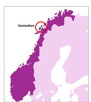
Langøya,
Vesterålen
Off the beaten track in Arctic Norway
Langøya is a large island in Vesterålen, directly north of Lofoten in Arctic Norway. It’s a beautiful place, offering a landscape that has a different flavour to Lofoten but far fewer visitors. Should you visit? Here is my introduction to Langøya for landscape photographers, to help you decide whether to go, and where to prioritise your time if you do.
About Langøya
Langøya is a big island in the centre of the Vesterålen archipelago, and home to one of its larger towns, Sortland. It’s an island with two faces. Langøya’s sensible side faces east, where the coastline is a smooth curve of sedate, flat meadows. Meanwhile, its western coast is a scribble of wriggly fingers and fjords, extending out into the Arctic Ocean.
The entire island is off the radar for most landscape photographers, and yet it’s a beautiful destination, easily reachable from far more famous Lofoten, or Andøya, both next door. Here’s an introductory guide to Langøya for those interested in landscape photography. I’ve concentrated on the area I know best: the northern peninsula of Langøya. It’s not a completely comprehensive guide - I’ve certainly missed some things! But consider this a useful starting set of suggestions and information if you like to explore off the beaten track.
Langøya is one of the largest islands in Vesterålen region. There’s a lot more to see in Vesterålen, though, and it’s easy to explore as Vesterålen’s main islands are all connected with bridges. See here for my introduction to Vesterålen as a whole for some ideas on how to spend your time once you are here.
On this page I’ll cover the following areas:
Nyksund, and also how to get there (part of the adventure):
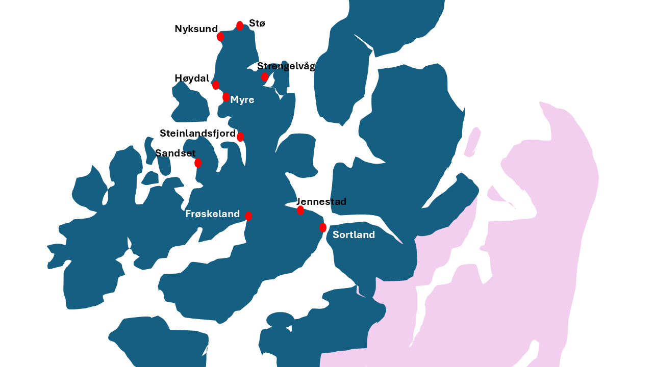
Sortland
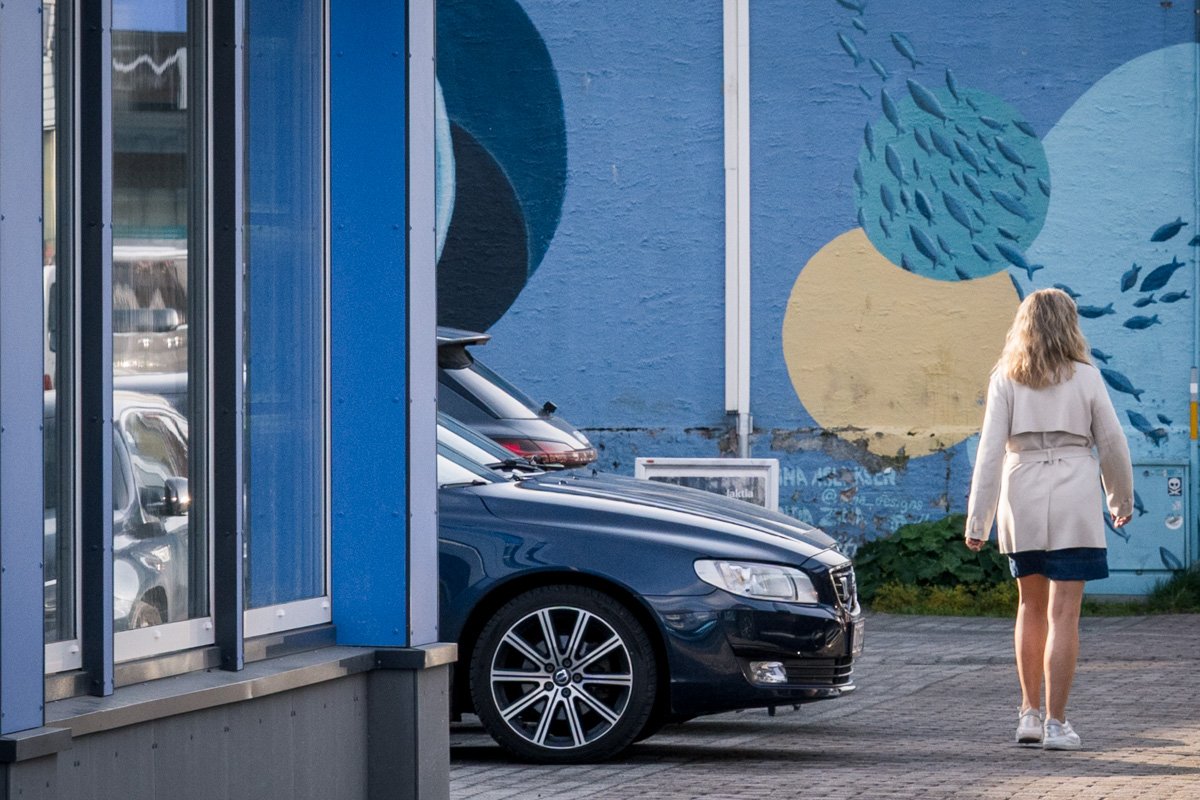
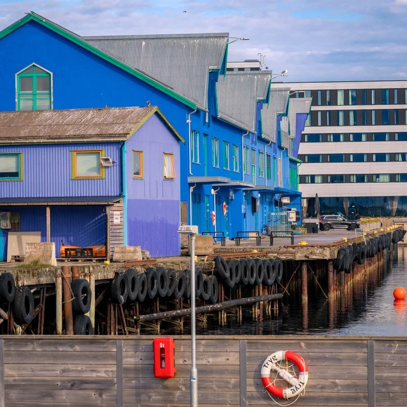
Sortland is one of the larger towns in Vesterålen, and good base for visiting Langøya due to its central location. Roads fan out from Sortland across central Vesterålen. From here, you can book a tour to see wildlife like sea eagles or moose or the Troll fjord, only accessible from the water. There are also handy services like hotels, restaurants, fuel stations and supermarkets.
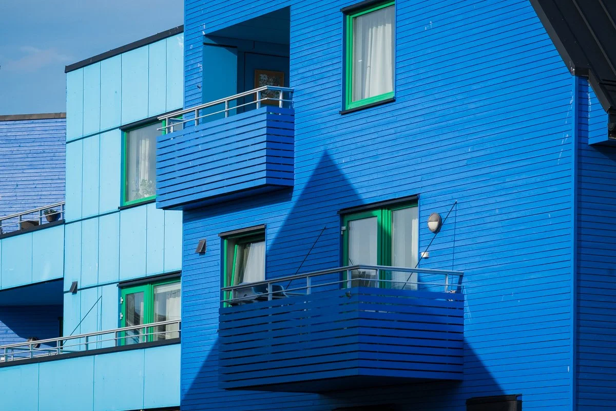
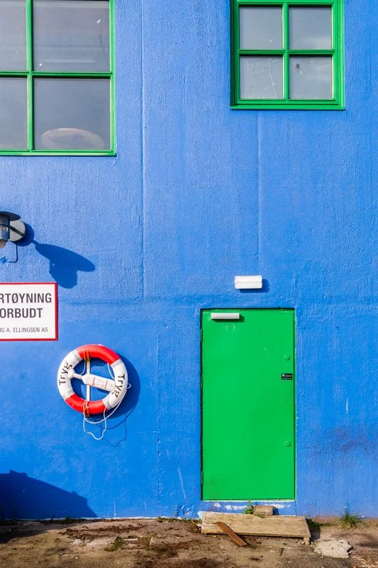
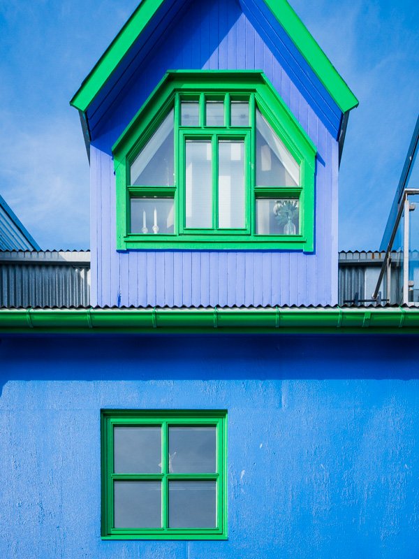
Sortland also has nice location, fronting onto a narrow channel between two mountainous islands. It’s also nicknamed the “blue city”, after an artist in the 1990s convinced the local authorities that it would be cool and unique to fill the town with blue buildings, turning it effectively into a town-wide art installation. The idea didn’t land with everyone - and only a minority of buildings are blue - but it is a fun idea and once you know to look, you will see notice more buildings than you would normally expect to see in an average town.
Apart from this, there aren’t really any specific tourist sights in town – it’s more a useful centre. If you do find that you have an hour or two to kill in the town centre, try taking a walk along the waterfront. There’s an art installation on the waterfront designed to frame the hills across the water, and a floating sauna in the harbour just in front of the Scandic hotel. You can find a handful of the blue buildings along the waterfront.
Just outside Sortland – about 10 minutes’ drive north – is a nineteenth-century trading post, Jennestad. The trading post itself is a white-painted wooden warehouse, prettily sited on the waterfront and surrounded with wildflowers in summer. It ceased operations as a trading post in 1982, but is now home to a museum and a shop selling local products (open summer only, fee applies, check opening hours and dates before visiting).
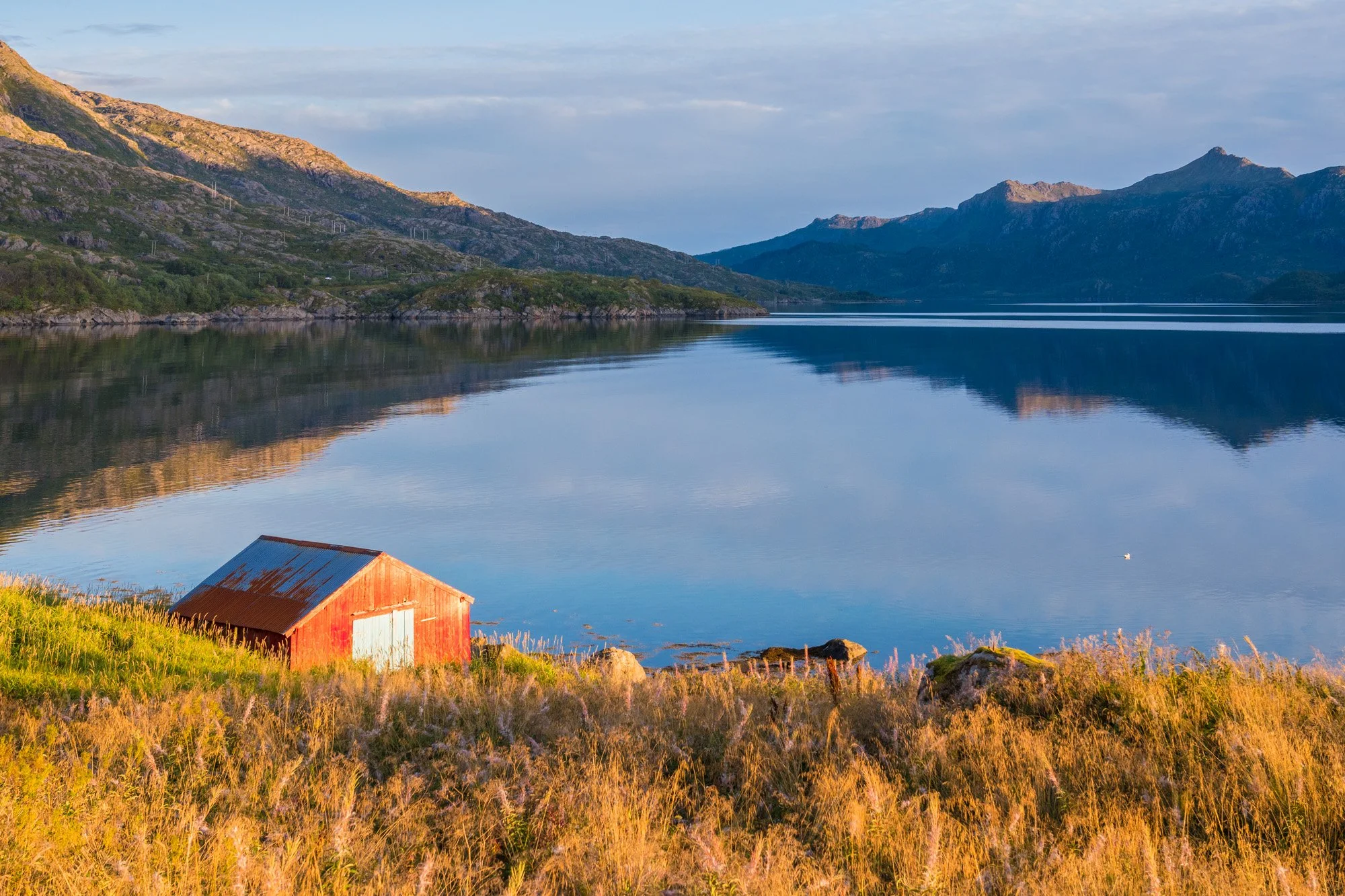
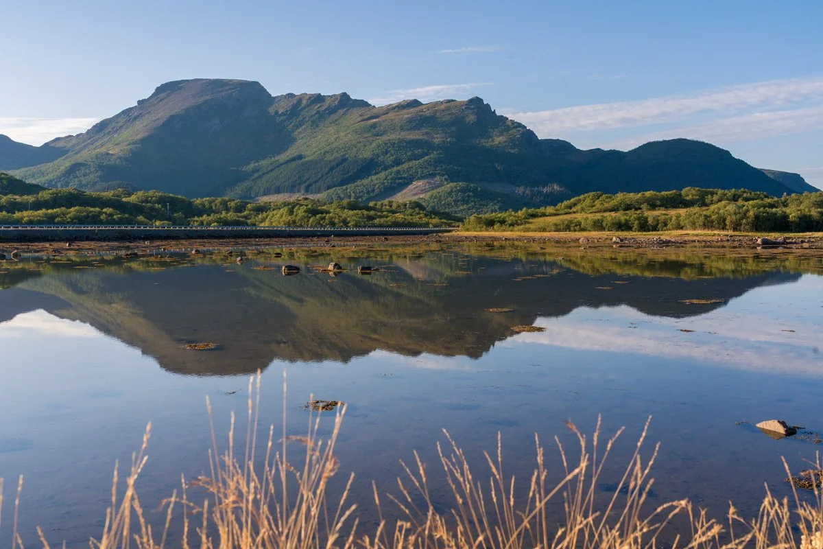
Steinlandsfjord
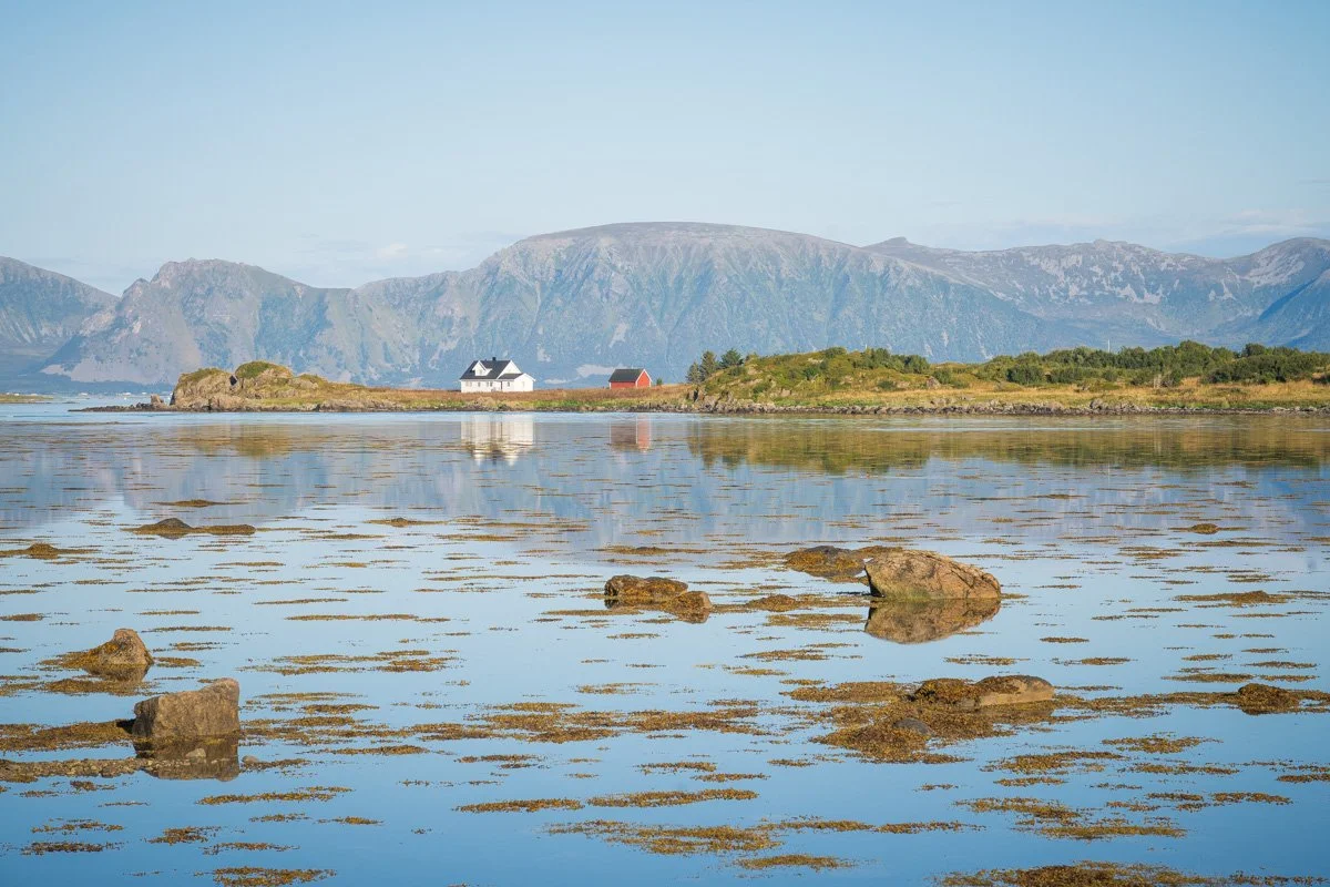
Driving north from Sortland along the 821 (the main road) will take you along the eastern shore of Steinlandsfjord. This narrow fjord is a quiet residential area, with houses scattered along the road. Across the water, on the far side of the fjord, are mountains with no road access. It feels quite peaceful.
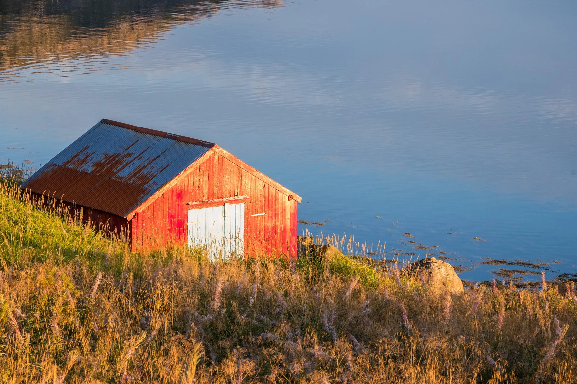
Along the shore between the road and the water are dotted a series of cabins, buried in meadows of long grasses and wildflowers. The fjord is lovely, but nothing special in Norway, except that it perfectly catches the sunset light in summer, and might be place to stop if you have good light at sunset. The views you might catch here would be details of fishing cabins, backlit wildflowers and grasses, and the quiet mountains over the water. There are a few places to park up safely without causing a nuisance (make sure you are not parking in a bus stop.)
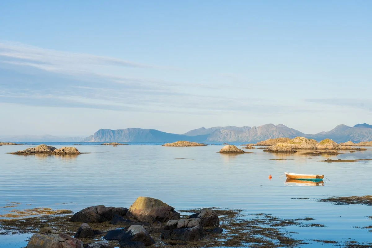
As you drive northwards, the road turns a corner and pulls alongside a stretch of water sheltered by a peninsula. The water here is calm and mirrorlike on a calm day, and has a few boats moored up – a good place for reflections on a sunny day, with the mountains of Skogsøya visible as a backdrop if it is clear. There are parking places here off the road. If you drive out onto the peninsula you will reach a beach.
At the northern end of this drive is the small town of Myer, which has a few holiday cabins and cafes in town. This is a nice little town, surrounded by sea and low mountains – on a sunny summer day it’s something of a suntrap, and you can see cafes and restaurants with outdoor sunterraces lining the road. It’s a good place to get lunch or a coffee and cake.
The 821 road terminates here – to go further north on the west coast (and you should!) you will need to turn towards Høydal.
Nyksund
Nyksund is a really unique place – well worth visiting if you can, not only for the destination itself, but also for the interesting trip to get there.
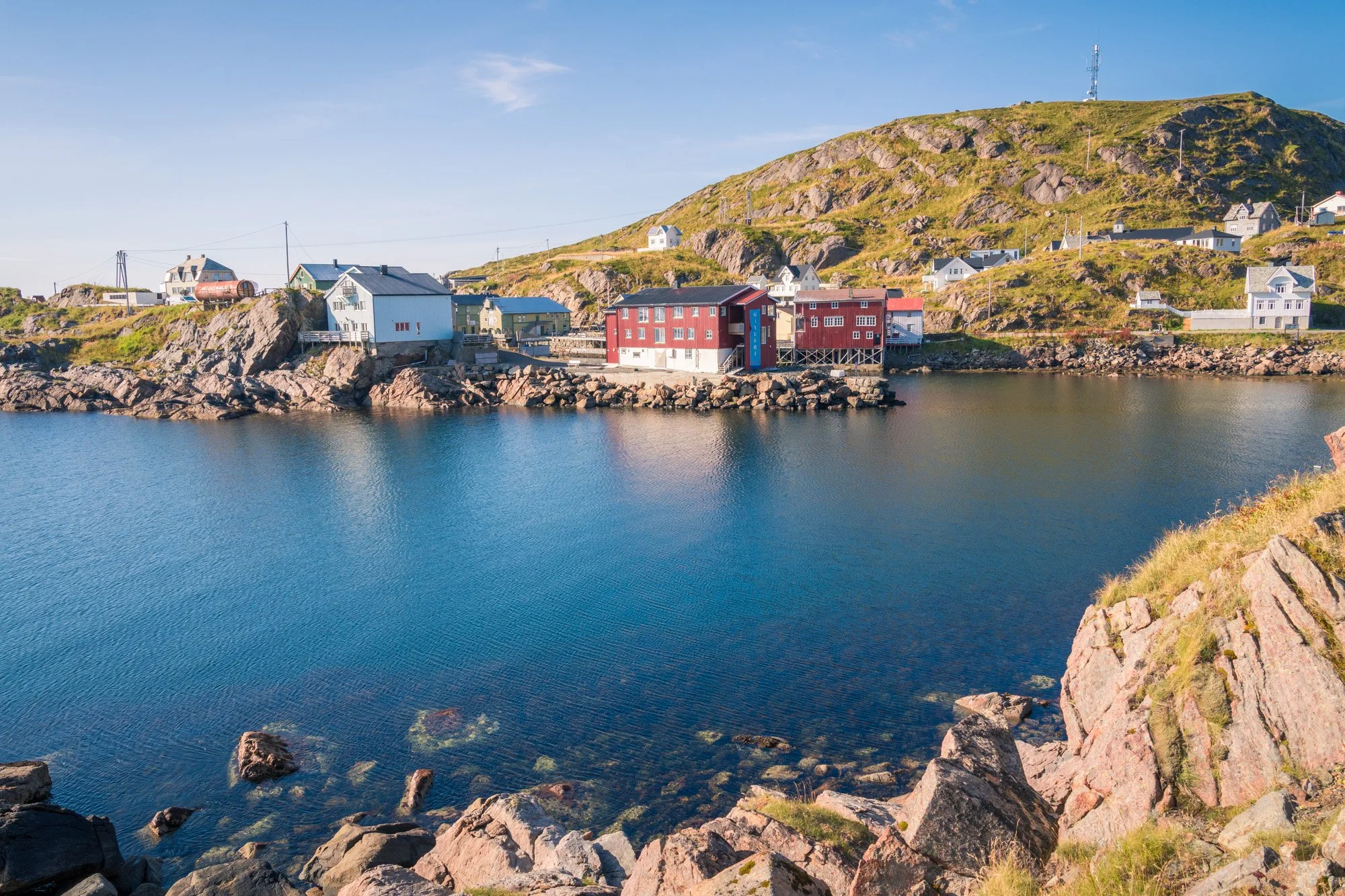
It has an interesting history. The area around Nyksund has been a rich fishing ground for over 1000 years, and the Vikings built an enormous longhouse here. It’s perfectly sited next to key cod spawning grounds and rich in fish. However, with a location at the extreme northwesterly tip of Langøya, it’s also a location that is difficult to settle, prone to storms, the road cut off in bad weather, and quite remote. In the 1800s that began to change, and the government began to encourage families to settle here to exploit the fishing grounds. By the late 1800s and early 1900s, Nyksund had become one of the most important fishing centres in Vesterålen and during cod season, workers flooded the area, to fish for cod, as well as unloading and processing it. The tiny harbour here – covering two little islands connected by a causeway – was rapidly built up of clapboard warehouses three and four stories tall, to accommodate the booming industry and boatloads of cod being unloaded.
Over the twentieth century, though, fishing changed. Across the industry, automation increased and boats became bigger to accommodate better, safer equipment. The tiny harbour here could not accommodate modern methods, and the fishing industry moved to Myer, less than 15km down the coast. Nyksund was abandoned.
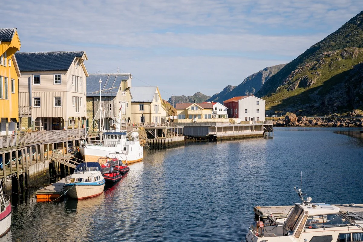
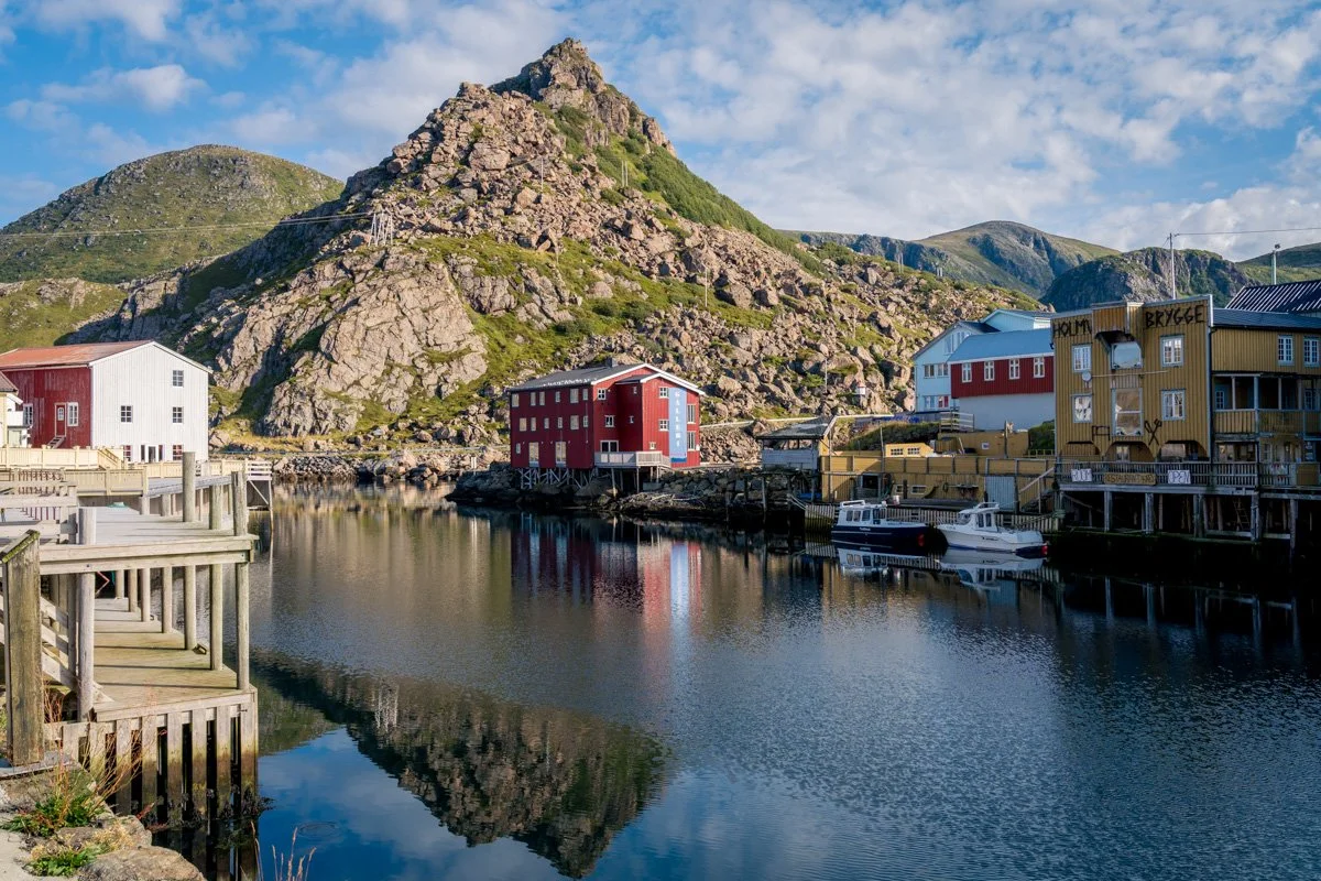
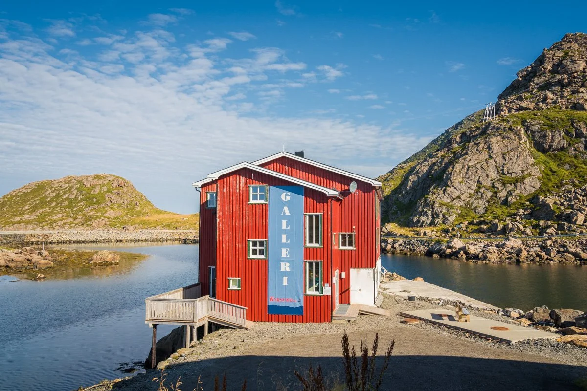
In the 1980s, a group of tourists from Germany rediscovered it, and started a project to renovate the historic harbour, installing a wind turbine for power and restoring some of the buildings. Initially they transformed it into a remote, off-the-grid artists’ colony and creative community. These days you will find a regenerated old harbour, prettily painted in brick red and home to a pub, restaurant and café, a few galleries and arts studios, cottages in which to stay and remote working spaces. Nyksund is still tiny – home to around 30 people all year – but it does get a steady trickle of visitors.
Why should you visit? Well, the location is a pretty one. The harbour itself sits in a slightly protected spot, sheltered by a headland that curls around it. The village itself faces south, where distant mountains are visible across an expanse of water dotted with rocks and islets. It’s a tiny place, with cabins and cottages clustered around the water and dotted up the surrounding slopes. You can walk around the small harbour, visiting the odd studio or gallery (check opening hours/dates carefully) and taking lunch (ditto). The restaurant has tables outside on the sundeck for good weather, and plenty of indoor seating if not, and excellent seafood regardless of weather. It’s a very quiet spot, great for getting away. If you really want a retreat for a few days, you can even stay in the village.
As you might expect, since it faces south west, the light is good for photography in the afternoon/evening.
Although Nyksund is an interesting destination, getting here is also part of the attraction. If you don’t have your own boat (I’m going to go ahead and assume you don’t), there are two ways to get here, both of which are scenic adventures in their own right.
Getting to Nyksund on foot
Nyksund represents the start/end of well-known hike, called Dronningruten Vesterålen (“Queen’s Route Vesterålen”) ever since Queen Sonya hiked it and liked it. Easily the most famous hike in Vesterålen, it cuts across the northern tip of Langøya, connecting Nyksund, on the east coast of the peninsula, to Stø village, on the northern coast, 7km away. Nyksund and Stø are both fishing villages, but they are quite different and visiting both makes for an interesting trip. They are separated by by steep hills, and there is no road connecting them directly (you can drive between the two – it’s just a 25km journey around the mountains).
Consequently, many of Nyksund’s visitors arrive on foot from Stø, have lunch in Nyksund and walk back to Stø, to make a long day hike. Note that the hike itself is not trivial, though, with 400m climb each way, it’s at least a 15km total round-trip.
I haven’t taken the hike myself - but you can read an account of the Dronningruten Vesterålen here.
Getting to Nyksund by car
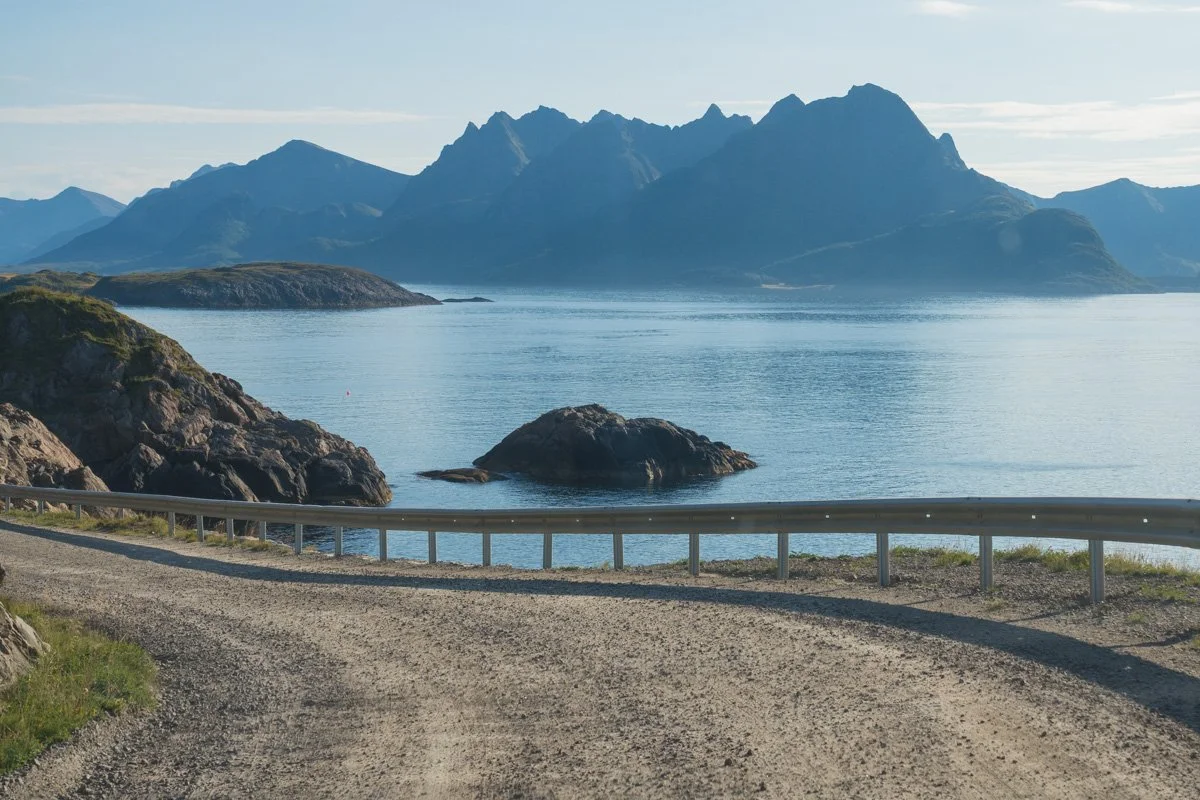
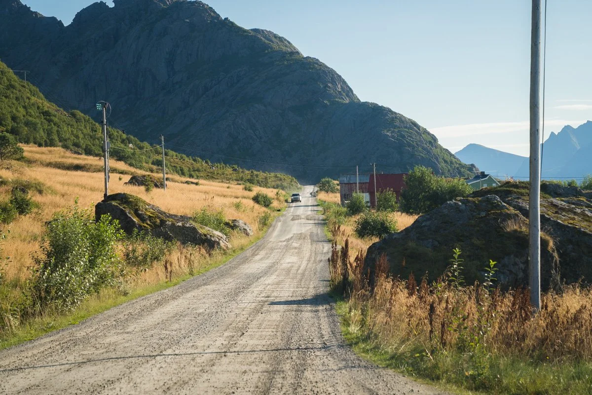
If you don’t want to (or can’t) reach Nyksund on your own feet or in your own boat, you will have to drive there. You can – and it’s an exciting and scenic route. Because Nyksund was abandoned and off-the-grid for so long, the road to reach it has never been paved. So driving there requires going first (on normal, paved roads) to Høydal, near Myer. And then joining an unpaved road, which twists its way for 9km up the west coast to Nyksund.
It’s an exciting drive - on some sections, the narrow road clings to the edge of the shore, with cliffs towering above you. On other sections, you pass grassy meadows, dotted with the odd farmhouse or barn, before reaching the old fishing village of Nyksund itself. The road does not climb high, though - it stays low, relatively close to the water level.
I did have some worries about driving an unpaved road in my 2-wheel drive car. However, the road itself is in decent condition and my worries proved unfounded. It’s not a gravel surface – more hard tamped earth with a few loose stones. I’ve added plenty of photographs so that you can see the road condition.
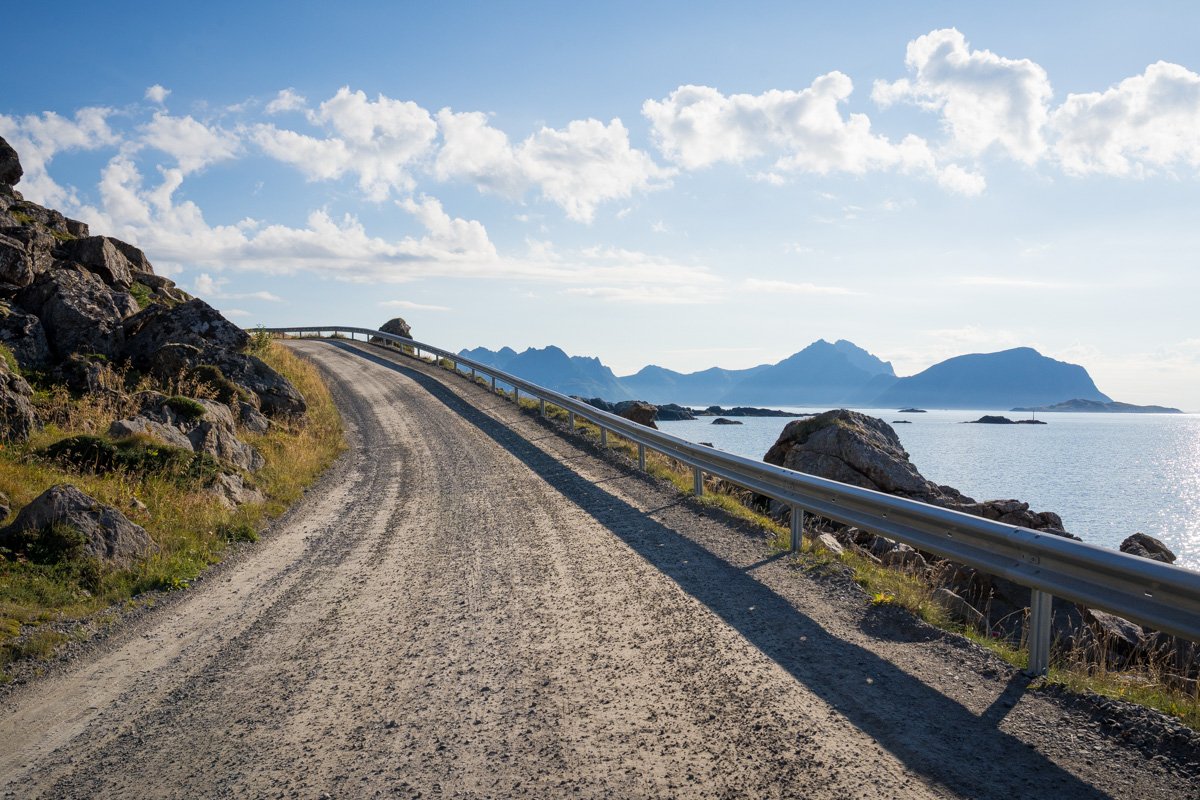
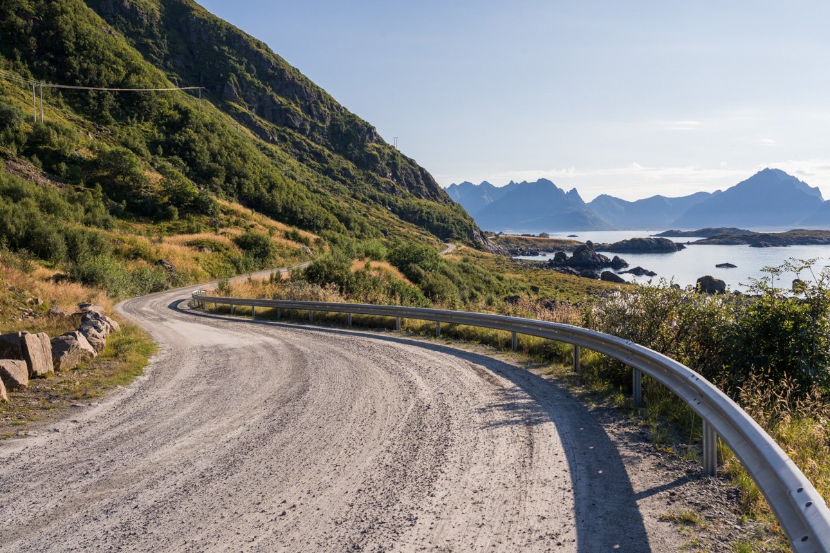
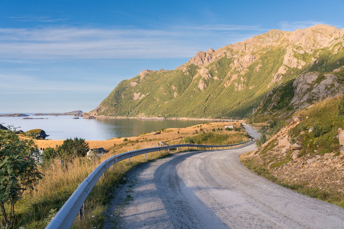
My advice: if it’s good weather, I would quite happily take this road without any worries. In some sections it’s narrow, with passing places (marked “M”). This is the same as many rural roads in Norway (and in other European countries, for that matter). Passing places are frequent. Sadly, though, there are very few places in which you stop safely to park and explore (photographs here were taken in the car, by the passenger) - although there is a place to park up just after the start of the unpaved section near Høydal.
In bad weather, as a tourist with a 2-wheel drive vehicle, I would postpone the trip.
Once you reach Nyksund, there is a carpark just on the edge of the village where you should park (fee applies). The road is not heavily trafficked, but in good weather you should expect to encounter a few other vehicles during the 9km drive. Don’t be tempted to park in a passing place - they are in constant use.
Nyksund’s official website is here. If you’re interested in Nyksund, you can read some interesting articles about Nyksund in the British newspaper the Guardian here, and in the Times here.
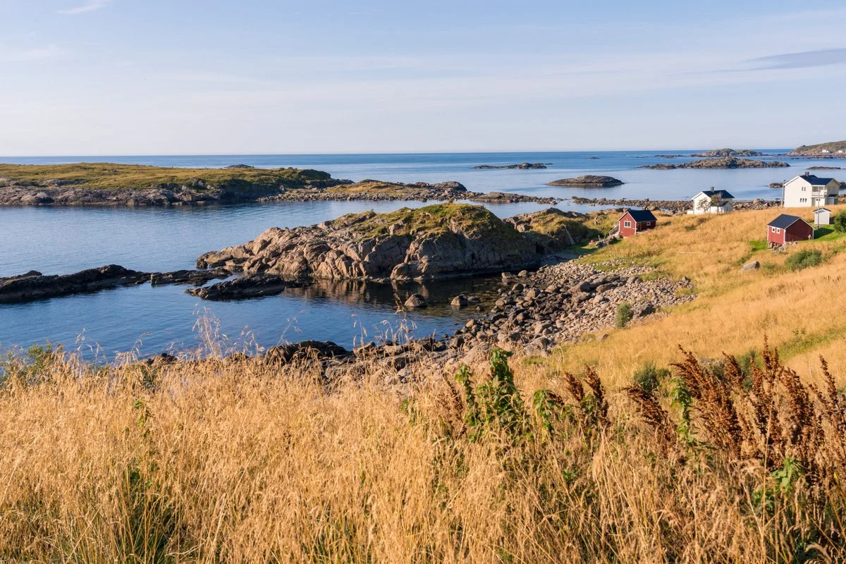
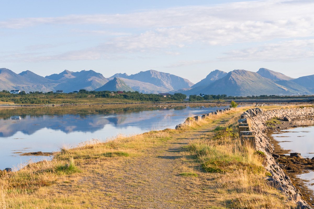
Strengelvåg causeway
Let’s leave the west coast, and drive up the east coast of the northern peninsula. North of Myer, instead of turning towards Høydal, keep straight ahead and when you reach a T-junction, turn left, all the time following signs for Stø. It’s only about 10 minutes drive from Myer to reach the turn. Almost immediately, the road plunges out over a large flat lagoon, mountains on the left, and the peninsula curling round on the right.
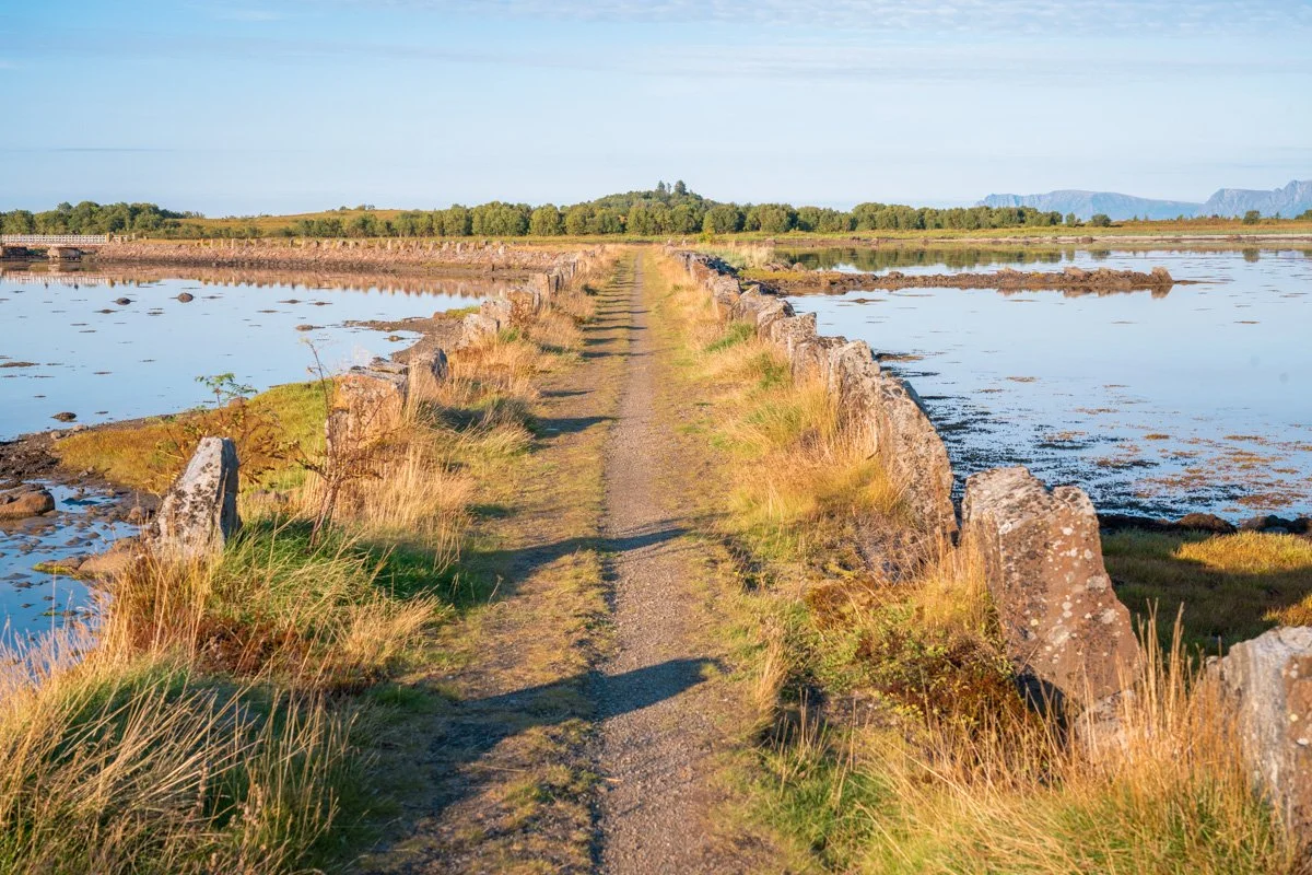
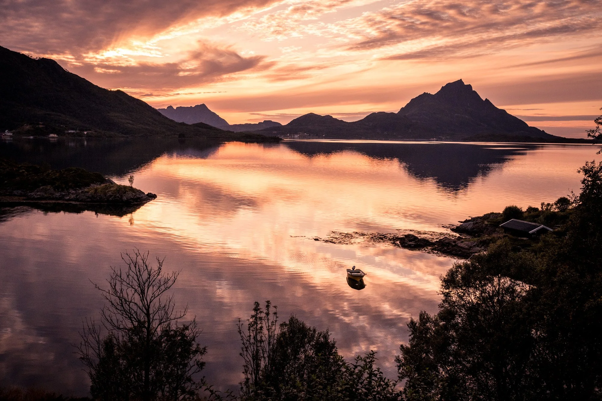
The road runs over a causeway, elevated over the lagoon itself, continuing for several kilometres over the water and almost completely encircled with mountains. On a calm day with low winds, this spot is beautiful, which reflections in every direction and lots of photographic potential. In the distance across the water you can see Andøya, with the cabins, cottages and reflections of Strengelvåg village in the foreground.
In the middle of the causeway is a small parking area, and a few footpaths circle around the area, including a footpath on its own, separate, elevated causeway. In the afternoon/evening, the sun sinks slowly behind the mountains on the western side, and lights up the views of cabins and mountains to the east (with reflections if the wind is low). And you might also get some interesting light and sunbeams peeping over the mountains themselves - with reflections - to the west. Meanwhile, facing south, the distant hills are beautifully sidelit (if the sun is out). The sun will disappear behind the mountains here completely an hour or two before actual sunset, though. Use an app like Photographers Ephimeris to work out the exact lighting, depending on the time of year.
In the morning, the opposite will be true: the mountains on the western side of the lagoon will be illuminated, while the cottages and cabins in the east will be silhouetted or backlit. The sun will be here shortly after dawn as it doesn’t have to climb over a mountain.
It’s a really beautiful spot to explore a little. The walks out over the lagoons are not very long or steep, but the footpaths going out over the water are extraordinary if you like reflections. Bear in mind that reflections probably won’t be present on a windy day (although you could bring a tripod and try some long exposures). The lagoons here are also tidal, and are considerably less dramatic at low tide - so pay attention to tide times if you are planning to make a trip here. It’s certainly worth a stop if you are passing through.
Advance notice: you might encounter the odd midge or mozzie here (although on the whole there are fewer than I expected).
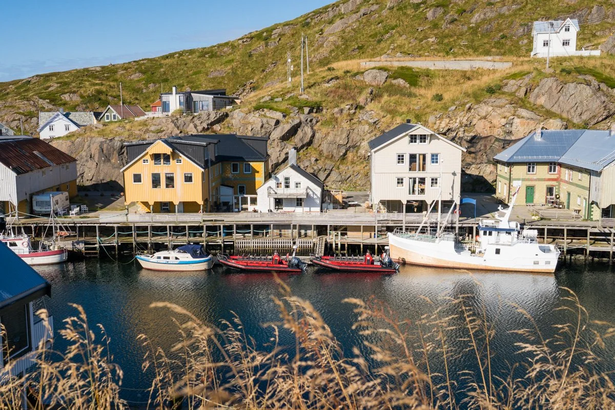
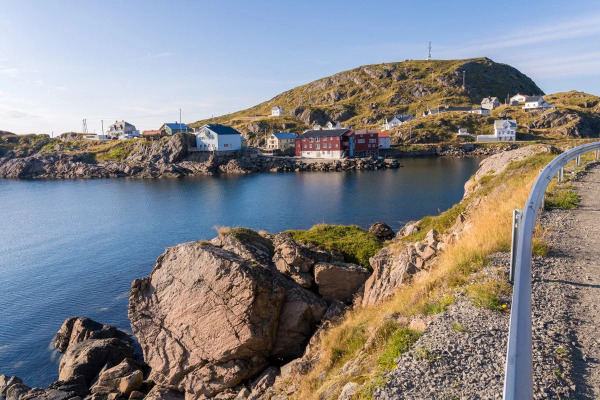
Stø
If you keep going north, you will eventually reach the end of the road at Stø, an active fishing village. This is the other end of the famous Queen’s Route/ Dronningruten Vesterålen hike to Nyksund.
Stø village itself is very spread out, scattered over rolling meadows with rocky outcrops, facing north and east towards Andøya over the water. And few minutes south of here is a lovely sandy beach. Stø prides itself on a sense of creativity and is known for the murals dotted around the town, and a calendar of interesting events.
North of the village, right at the end of the road, is the working fishing harbour, an area of commercial fishing boats and buildings. You can get boat trips from here to see whale, seals and seabirds, and the trailhead for the famous hike to Nyksund.
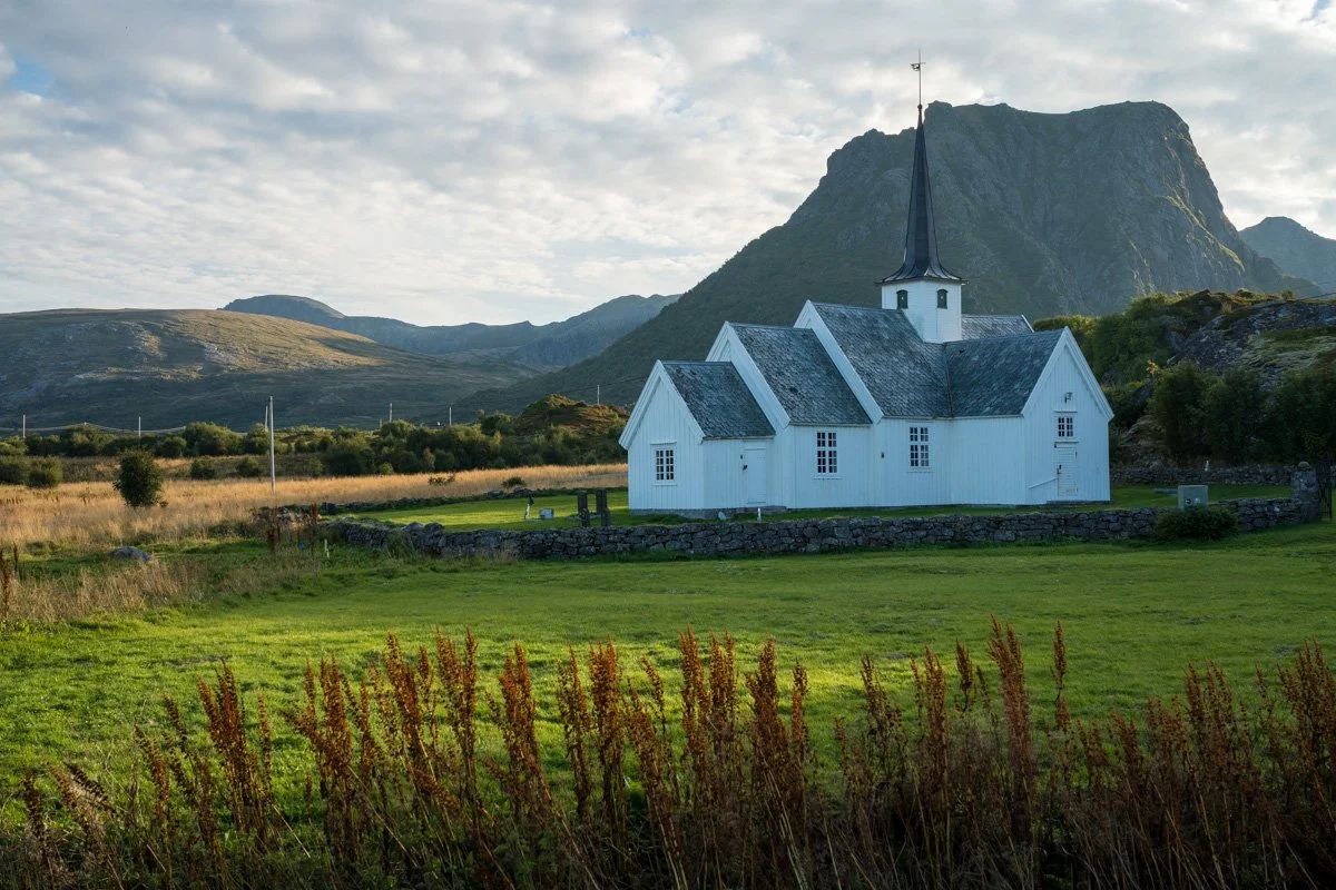
You’ll find carparking opposite pretty, white-painted Langenes Church, east of the harbour. This church dates from the 1700s, and is one of the oldest in northern Norway. It’s tucked in amongst low hills, protected by rocky outcrops and with a wonderful view over a sheltered stretch of water. The shoreline here faces east, towards Andøya, forming a lovely bay dotted with rocky islets and the odd rowing boat that glow gold in the evening (if the sun is out). If the wind is low there are potentially some smashing reflections here. It’s a beautiful location.
The sun disappears from the church (and east-facing shore) an hour or two before sunset, as it dips behind the inland mountains at the village’s back. If you’d like to photograph the church, consider coming early in the morning - or at least don’t do what I did, and leave it until close to sunset, because the church will be in shadow.
Frøskeland
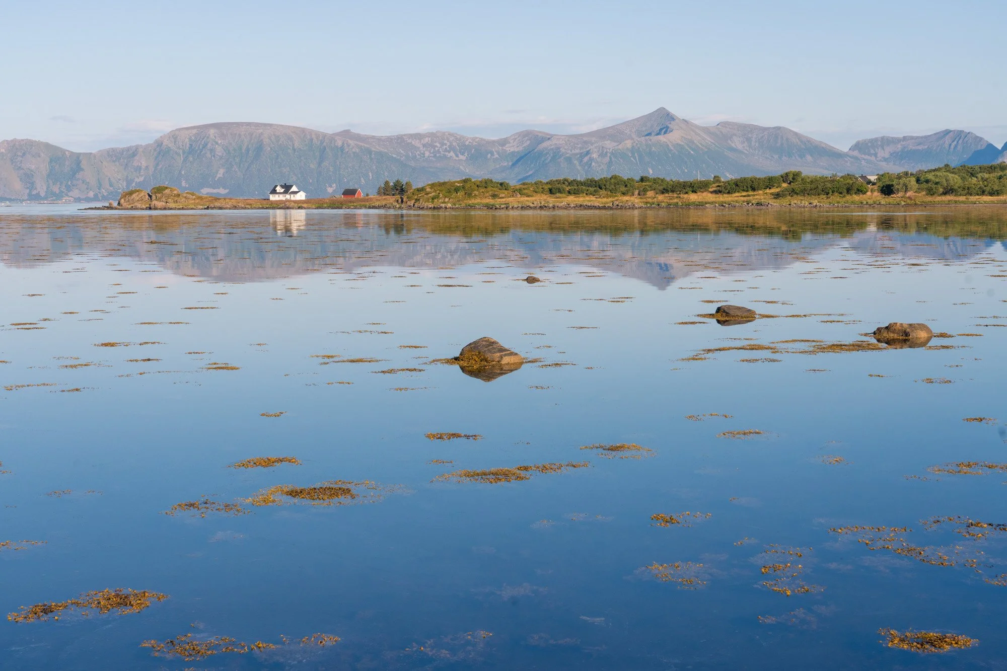
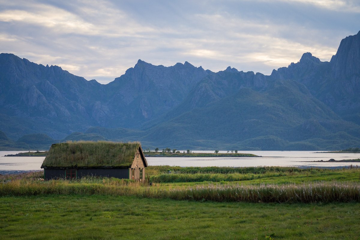
Heading west from Sortland, you will soon be driving through Frøskeland. This is an area of flat meadows, with the hills of northern Langøya on the right, and a wide bay on the left. Jagged peaks of western Langøya are visible in the distance. In summer, lush green grasses and wildflowers fill the area. There are a few photogenic cabins scattered around, including several with turf roofs and dramatic backdrops of sea and mountains. The light here is good at different times of day as it’s open to the south. Morning light here would potentially let you capture cabins with illuminated mountains in the distance, though.
There are a few places to stop the car and explore the view, but as always, be aware that this is an area where real people live and work, so park considerately, making sure you are not blocking a bus stop, access point for tractor or driveway. You may need to park some distance away and walk.
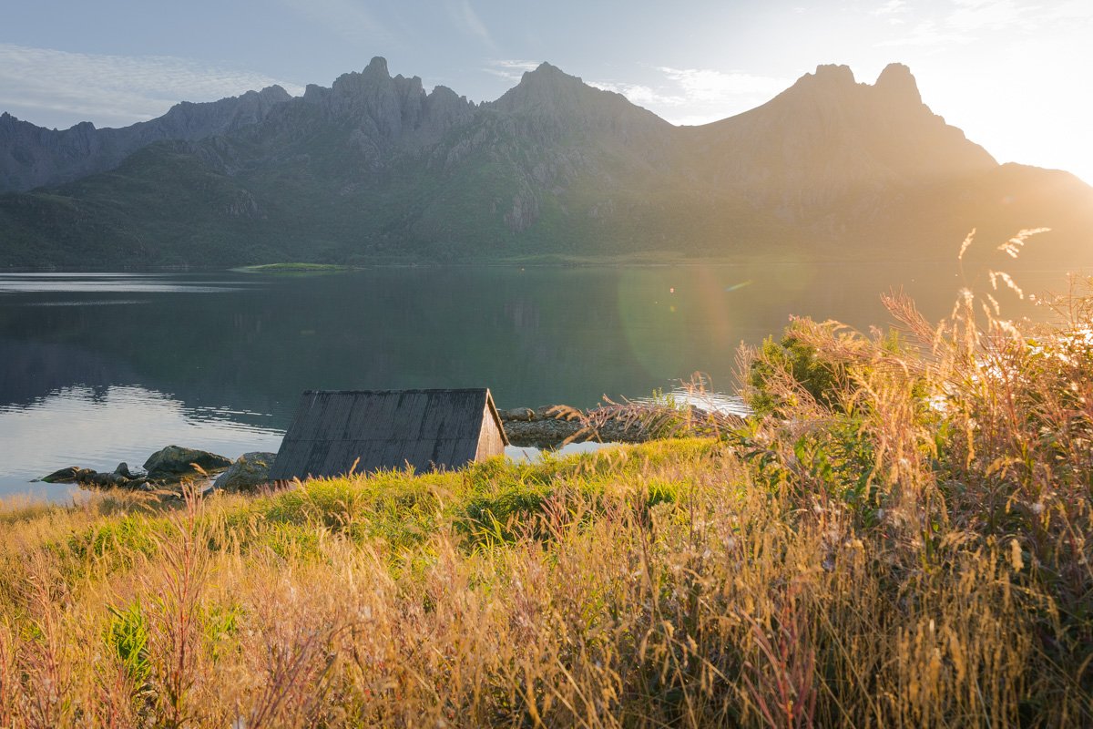
Sandset
Continuing west from Frøskeland, the mountains step forward suddenly on both sides and you will find yourself driving through a narrow fjord, peaks towering above . In late summer, the sun shines directly along the length of the fjord at sunset, making it a bit hard to see - but also creating some stunning lighting.
Pull down your sun visor and continue driving for a few minutes until you reach Sandset, where the mountains step back again and the fjord opens out to an enormous bay. Mountains are visible across the water, in the distance, and islands fill the spaces. There is a viewpoint area here with a carparking area, elevated above the water. The shoreline below you, is a gentle curve with fishing cabins and the odd rowing boat.
At sunset in late summer, sun is shining straight into your face here. If there are clouds in the sky and low winds you may be able to get some great sunset colours reflected in the water of the bay, while the sun sets behind mountains in the distance.
This could also be a great location in the morning, with light coming over your shoulder to illuminate the scene in front.
Useful links and sources of information
Here are links that may be helpful:
Tourist information at Visit Vesteralen and the Northern Norway tourist board
Heart My Backpack and Life In Norway are both wonderful blogs, packed with heaps of useful information if you are planning a trip to Norway
If you want to explore Norway’s National Tourist Scenic Routes (Nasjonale Touristveger) you can read about all 18 routes here