
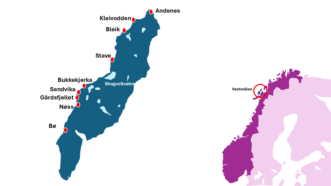
Andøya
Scenic Route
Complete Photographer's Guide
Andøya is readily reachable from Lofoten, is a designated National Tourist Scenic Route (Nasjonale turistveger) and offers a whole lot of that stunning Arctic scenery. And yet it’s very much off-the-radar for landscape photographers. Should you visit? On this page, I describe the whole of Andøya Scenic Route, pointing out stops I think will be of interest to photographers, to help you decide whether to visit and how to spend your time if you do.
Andøya is an island found in Vesterålen, and Vesterålen is a region that spans multiple islands directly north of Lofoten, in the Arctic region of Norway.
Although the Scenic Route described here is undoubtedly a highlight of a visit here, there’s a lot more to explore in the rest of the Vesterålen, too. See my general page on Vesterålen here for more information about Vesterålen in general.
Below is a sketch map of Andøya, and of Norway generally.
Throughout this page, I’ve assumed that your trip starts at the town of Andenes (at the northern tip of Andøya island). If you arrive from Senja, via the Senja-Andøya ferry this is the start of the Route. However, if you are driving towards Andenes from the south, the sequence of stops will just be reversed.
When I visited it was in late summer (August/September) and my descriptions of the light and its direction will reflect that (by the way, here are some things to know about Arctic light for landscape photographers if you haven’t been this far north before).
Although I’ve tried to be comprehensive, I’ve certainly missed some things – consider this page a starting point. I’ll cover:
Sandvika
How long should photographers spend on Andøya Scenic Route?
The official Scenic Route Andøya is not too long, at 58km. However, it’s easy to fill a lot of time if you want to stop for photography! Here are my suggestions.
Half a day: Excluding time to arrive/depart from the end points, allow an absolute minimum of half a day to travel over the length of the Scenic Route. This is enough time to travel in one direction only, between e.g., Andenes and Bø. There’s enough time to get out of the car regularly for photography, for lunch or a small diversion (e.g. a shortish walk to explore a beach). It doesn’t allow time to visit attractions such as the Space Centre at Andenes, a whalewatching safari or boat trip, or a hike. If you only have a half day, I would strongly recommend afternoon/evening - the entire Route faces west and evening light is wonderful (if the sun is out). If you arrive in Andenes on the morning Senja-Andenes ferry, you could spend half a day on the Andøya Scenic Route, making your way towards Sortland.
One day: I could easily spend a full day on this Scenic Route. This would allow you to either make a thorough exploration of viewpoints and stops, or to add on one of the more timeconsuming additions (such as a boat trip, museum or a hike). To do this, you could spend a day driving towards Andenes, and then just take the Senja ferry on the next day. Or you could drive north in the morning, lunch in Andenes and drive back south in the afternoon.
Two days: Spending two days exploring the Scenic Route would allow you to add in some longer side-activities. You could return to your favourite viewpoints more than once, explore the viewpoints in more depth, and take a hike or visit a couple of attractions. To achieve this, you could arrange to drive north from Sortland up the Scenic Route on one day, stay in Andenes, and then south on the return trip on the next day.
Three or more days: This time scale is a generous allowance to explore the Andøya Scenic Route. It would allow a more thorough exploration of the Scenic Route at a relaxed pace, as well as spending time on longer attractions such as taking a whalewatching trip and some decent hikes, and/or adding in trips to other parts of Andøya.
Norway has a maritime climate and the weather changes frequently. My own experience of visiting Norway repeatedly tells me it’s reasonable to expect a big mixture of conditions, so my golden rule is to stay for multiple days in one area if I possibly can. That maximises the chances of seeing places in a variety of conditions.
Sandvika
Evening and sunset photography locations
The Scenic Route runs along the western side of this long, thin island, so afternoon and evening are great choices for landscape light throughout the entire Route. My personal top picks for for sunset/golden hour photography would be:
The area around Gårdsfjellet. Small beaches glowing pink in the evening sun, framed with craggy rock formations, distant mountains across the water, and the sun setting over the sea.
The area from Gårdsfjellet to Nøss. Dramatic cliffs, the road clinging to their feet, and fingers of rocks extending into the sea towards the setting sun.
In late summer, if there is late sun - I would also consider the area around Bø. A small strip of meadows between mountains and sea, rocky shoreline dotted with boulders, views of distant mountains across the water, edged with meadows of long yellow grasses. The grasses here are backlit at sunset and glow intensely gold during golden hour.
For the last hour or two before sunset, on a clear day with no clouds on the horizon, the light is fantastic at all these locations – intensely gold everywhere.
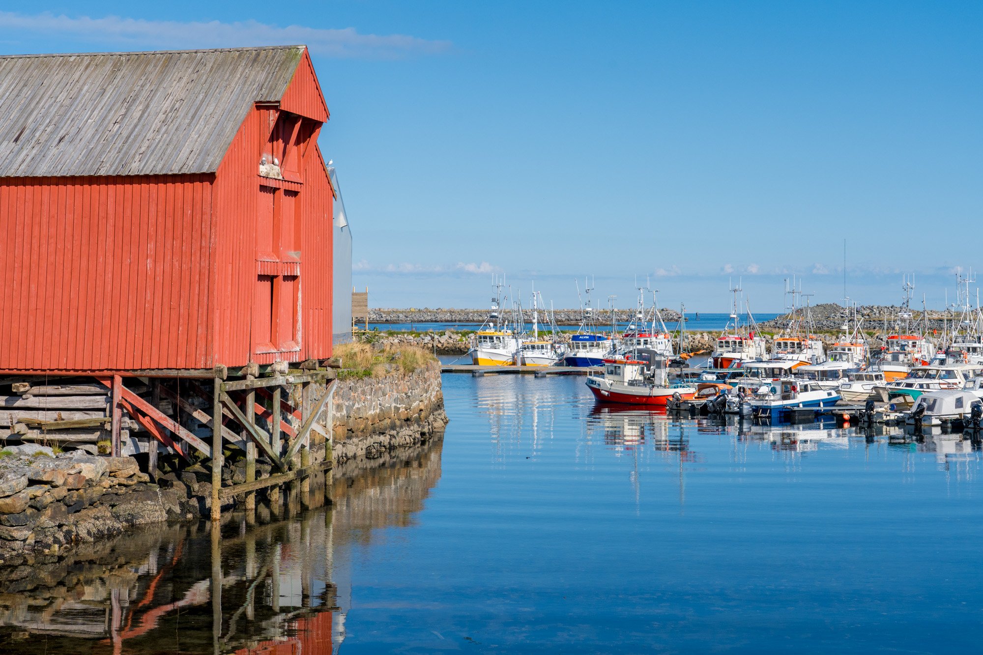
Andenes
Andenes
If you arrive by ferry from Senja, Andenes is the first port of call. Andenes occupies an area of flat land at the very northernmost tip of Andøya. Just off the shore here is a deep sea trench, filled with juicy squid and other tempting whale snacks, and as a result, the waters around Andenes are packed with whales for most of the year. Formerly a whalehunting centre, Andenes is now famed as one of the world’s top spots for whalewatching.
Not surprisingly, then, Andenes is a breezy seaside kind of place. The town turns its face north to the open sea, with its back to a row of triangular peaks in the distance. North of here, there’s no more land until you reach Svalbard, almost 1000km away. The streets are filled with scrubbed-clean wooden cabins and crisply-painted clapboard, framed with blue seas and cheerful Arctic fishing boats. Even in warm, calm weather there’s a freshness here, a salty breeze coming straight off that 1000km of ocean. The town itself hunkers down low, mountains lounging in the distance. Although it faces north, the town mostly gets good light morning and evening, as it’s not shaded by hills or tall buildings in any direction.
There’s a ferry dock on the eastern end of town, terminus of the summer-only Senja ferry to Gryllefjord – this is where the Scenic Route officially starts. You can roll off the ferry and start Scenic Routing immediately!
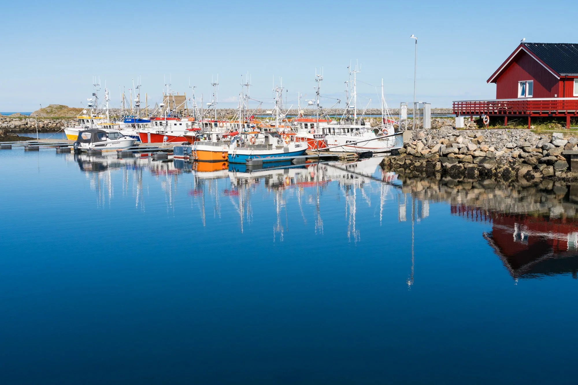
I suggest parking up near the northern edge of town, and walking east-west across the waterfront. There are a couple of marinas here, sheltered by breakwaters and filled with colourful fishing boats, the water mirrorlike on a calm day. Along the waterfront, you’ll walk past whalewatching operators, colourful rorbuer and the odd vintage wooden warehouse, hanging on stilts over the water. At the eastern end of town is a Whale Safari tourist centre (Hval Safari): a collection of museums in restored historical buildings, a café and desks offering whalewatching, all watched over by a low lighthouse.
On a calm day the waterfront itself is lovely, with mirror-like reflective water. On any day, though, there are opportunities here for colourful shots of cabins, fishing boats, water and the lighthouse. If it’s open, you can climb the lighthouse, and if it’s clear, you can also get a great view.
Whalewatching trips head out to the open seas throughout much of the year, in boats of various sizes, and in fact many people make the trip here specially to see whales. I haven’t taken a whale safari myself (I definitely didn’t allow enough time to explore Andøya) but the tours review highly.
There are several cafes and restaurants in Andenes but pay careful attention to opening hours & dates – tourist-oriented businesses often have different opening hours in different seasons. Whale watching tours have a very long season and operate outside of summer – but not all of the cafes in town will always be open. When I visited on a Sunday in early September, almost all the eating places were closed. If you are in the same position, try the Whale Safari buildings on the north western edge of town where there’s a cafe. It’s also useful to know that you can also get (good, freshly cooked!) burgers at many fuel stations in Arctic Norway! There’s a petrol-station-burger joint just outside Andenes if you are stuck.
Andøya Space Center
Andøya island is long and thin with mountains along its western side. There is a fast highway that travels along the east coast, but we don’t want to take this route. We want to take the Scenic Route, which travels along the western coast, tucked tightly between the mountains and the sea shore. So, following the (well-signed) Scenic Route, you will head to the west of Andenes and then south. Shortly after leaving Andenes, look out for the turning to the right, towards Bleik – this will take us down the western coast.
The road now curls around between pointy peaks and almost immediately you will reach Andøya Space Center), which carries out research and space education, including data gathering about the aurora. There’s a visitor centre and a diary of events.
Kleivodden
Shortly after the Space Centre, you will reaches its first viewpoint, at Kleivodden.
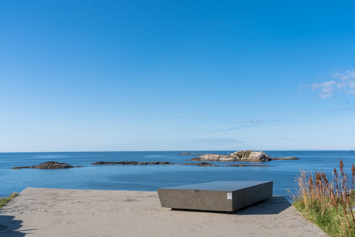
Kleivodden
This is a headland with a pull out and rest area, squeezed into the space between a rocky foreshore and looming cliffs. Like most of the stops on Norwegian Scenic Routes, there are some cool sculptural installations at the rest stop. Kleivodden has clean white steps leading out on the rocky foreshore and shiny black slabs for seating – these reflect the sky so cleanly they look like water.
You can get nice views here, especially facing south towards Bleik where there are beaches and a bunch of photogenic triangular sea stacks, like a bar of Toblerone - visible in the distance. A telephoto lens might be useful as the seastacks are quite distant.
As with the entire Andøya Scenic Route, the light is stupendous on a sunny evening, although I found the stops further south more dramatic and prioritised going there during golden hour.
Kleivodden
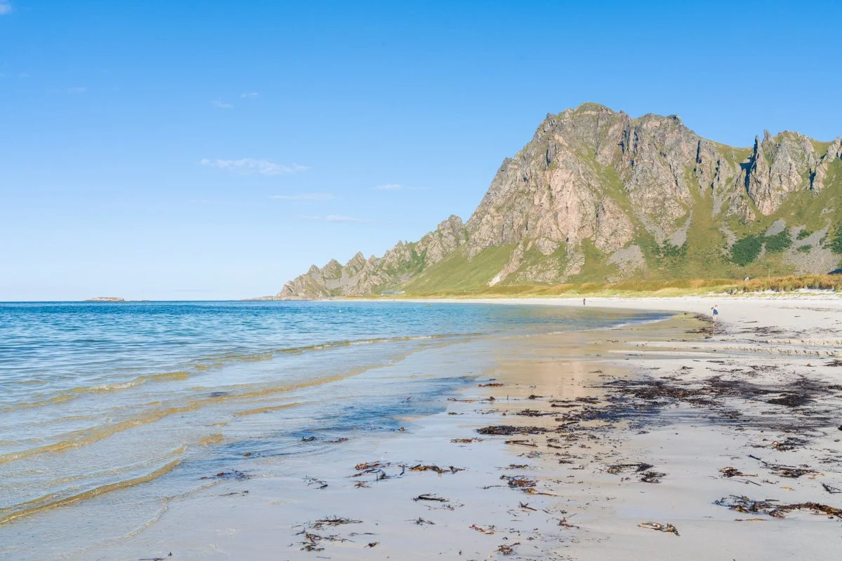
Bleik and Bleikstranda
Heading south, the road initially tucks itself tightly under the mountain faces, but then turns a corner. The mountains step back from the coast, leaving a flat valley floor of meadows next to the sea. Here is Bleikstranda – a beautiful crescent-shaped beach of soft white sand and shallow turquoise water, lined with lush green meadows and hemmed with mountains.
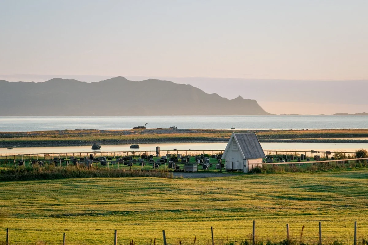
Turning left here will take you away from the sea, towards an old church yard, and eventually to the foot of the hills where there are some well-known hikes. Meanwhile, on your right is a seashore golf course with a beautiful beach surroundings.
The road itself does not stop at the beach but heads straight to Bleik, a village at the beach’s southern end. Going into Bleik is an easy way to reach the beach – you can park in Bleik pretty easily and then walk up the soft sand. On a warm summer’s afternoon you’ll definitely want to spend some beach time here chilling out.
Standing on the beach and facing north, you can see the craggy cliff faces of the mountains around Kleivodden. And turning to the south, you can see the next craggy headland, as well as some offshore islands and seastacks, pyramidal shaped and inhabited by seabirds.
Bleik has some services and places to camp. There’s a marina in the town with great views up and down the coast, as well as back inland.
Stave
The Scenic Route next turns inland to circle around the mountains for the next few km before heading back to the shore again. Along the way, you will pass several lagoons and lakes in a narrow, flat valley inland, with hills to your right and left. I found this area a pretty drive, but didn’t find any compositions that I was happy with (and personally I prefer to prioritise other viewpoints). However, there are a few places here and there where you can safely pull out to see the lagoons, packed with wildflowers and birds.
After a few kilometres the road rejoins the shoreline again near Stave, which makes a sort of mini-crossroads. The Scenic Route heads resolutely north-south. A side road here turns west, into Stave village. And on the east is a very accessible lake alongside the road, and a safe place to pull over and stop.
Stave, to the west, is a long row of houses, tucked tightly under photogenic, craggy cliffs towering over the sea. A series of glorious white-sand-and-turquoise-water beaches line Stave’s waterfront, together with a fishing pier and plenty of rockpools. Continuing to the end of Stave brings you past these beaches and eventually to a dead end.
Follow the Scenic Route south from this Stave turnoff, and almost immediately you will reach Stave Camping and Hot Pools. In season this resort has a very handy café and reception which sells coffees and cold drinks. It also has access to yet another magnificent beach with soft, dreamy white sand, and plenty of black rockpools for interesting foreground. This is another beach you will want to sit on if it’s warm and sunny.
Looking north from this beach, you will be looking towards Stave and its backdrop of craggy peaks. In the other direction, southern end of the beach is called with a rocky outcrap, extending fingers of black rock into the sea - plenty of potential if you like seascapes. Offshore, the shallow turquoise water is dotted with rocky islets. The beach faces west. If there is sun, afternoons and evenings have great light.
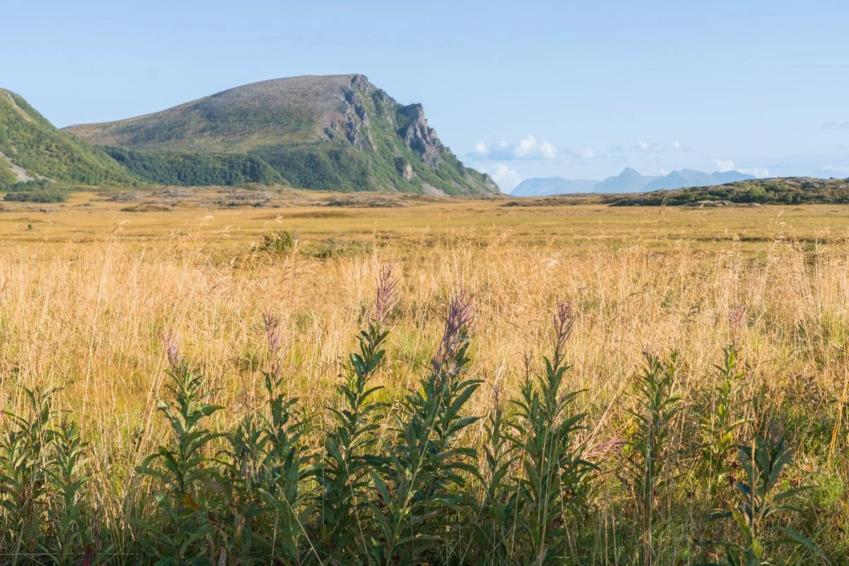
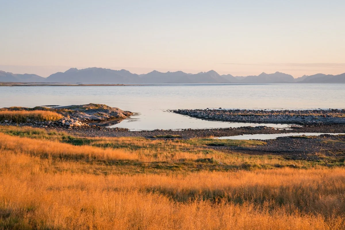
Stave to Berget
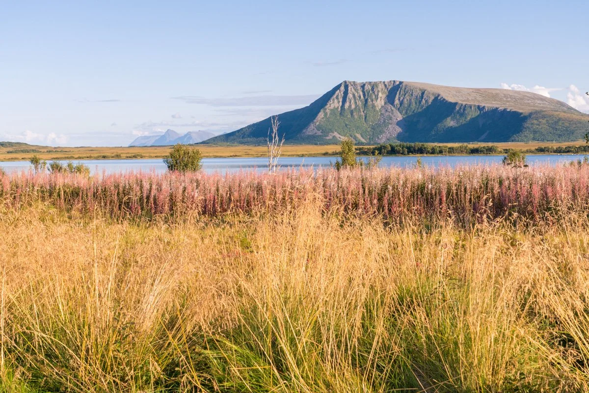
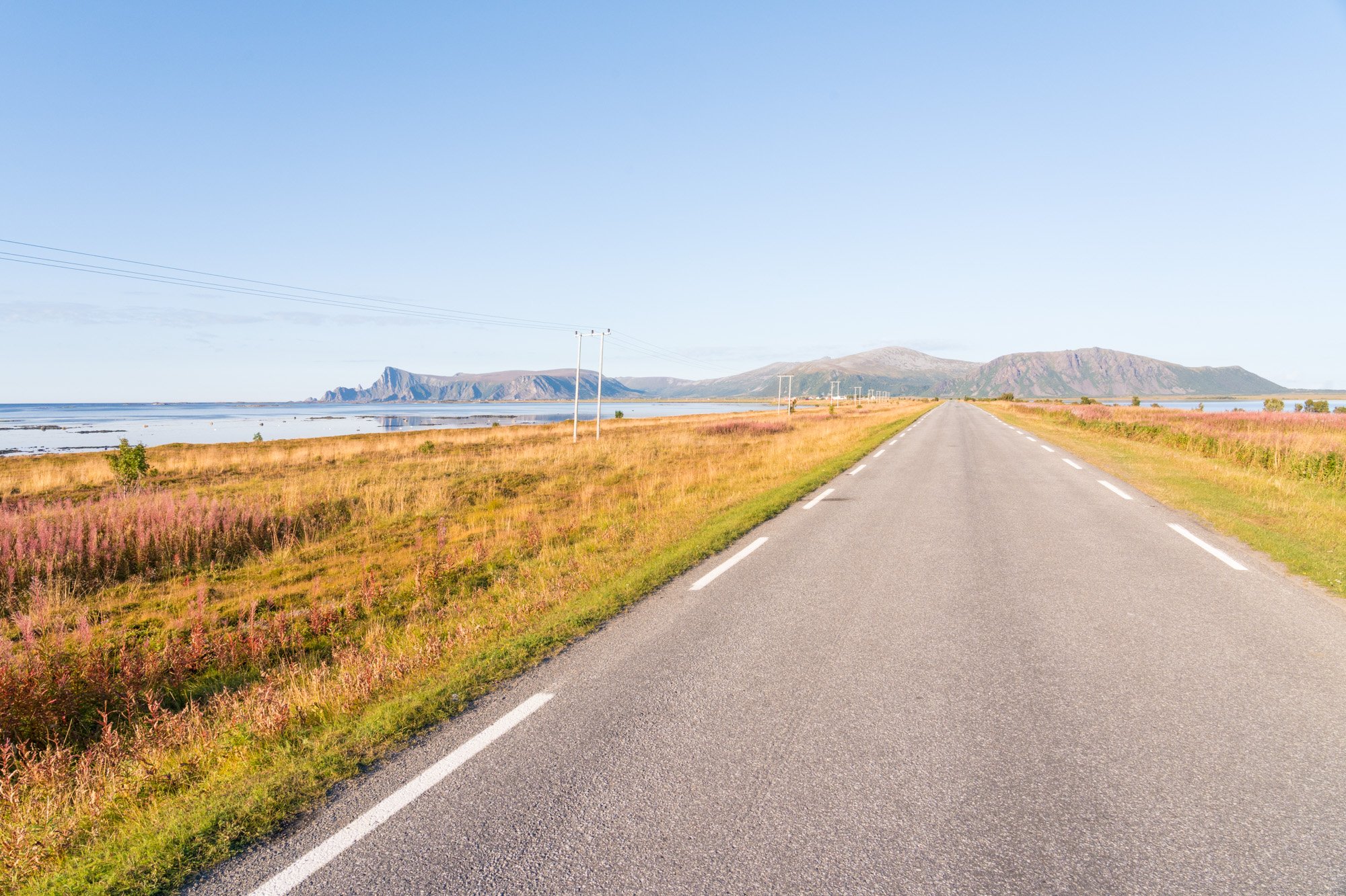
Moving south from Stave beach, the Scenic Route crosses a flat valley for the next few kilometres, a landscape not unlike the Uists in the Scottish Hebrides. There are plenty of opportunities for photography here, particularly if you like big skies or shorelines.
With mountains to the north and south, this low valley slices across the island from east to west. The valley floor is dotted with marshland, lush sheep meadows, lagoons and wildflowers alongside the odd farm and churchyard. The Scenic Route itself travels along a slightly elevated ridge between the sea and lake Skogvollvatnet.
The road here was pretty quiet when I visited, but not deserted. As people live and work here, try not to let your car cause a nuisance; don’t block farm tracks, driveways or field accesses and pull off the road properly and safely if you want to sightsee. There are one or two places where a couple of vehicles can safely pull out and stop without causing an obstruction.
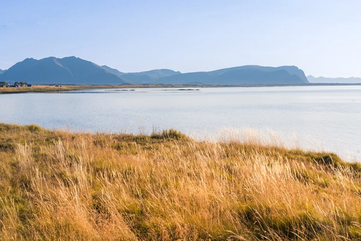
To the west is the beach and the sea, separated from the road by peaty moorlands. Look for established footpaths here and avoid treading on the bouncy – but delicate - undergrowth. The sea along this section of the shore is sheltered by natural breakwaters of sandbanks and rocks, creating a shallow, smooth, mirror-like sea stretching across the beach, dotted with white or black boulders. In calm conditions it’s possible to get shots of this with reflections in the midground and wildflowers in the foreground. The coast curls around slightly here, allowing you to achieve compositions with the northern mountains as a backdrop. A telephoto might be handy for picking out details in the composition; the views are quite expansive.
The afternoon and evening sun falls across the whole scene beautifully. However, as there are no mountains to the east here, morning may also produce some usable sidelight. You could use an app like the Photographer’s Ephimeris to plan your shot.
Meanwhile, to the east of the Scenic Route road is a lake, Skogvaollvatnet, surrounded with wildflowers in summer. The lake is slightly higher than the sea, and I found that the lake surface was ruffled gently in a breeze, even when the sea was flat like a mirror. I also found it more difficult to compose interesting shots here, as it has less varied foreground and background – but you may have more luck than I. Mornings might produce calmer water.
There are also some potential shots to be had of the valley in general, the road or surrounding fences as leading lines, and colourful cabins as interesting midground.
Berget and Nordmela
The road carries on south, reaching the villages of Berget and Nordmela, a cluster of red, white and black houses dotted alongside the road and separated by a river. There are some services here including a café and restaurant.
This area of the Scenic Route is flat – in summer, lush green meadows and wildflowers stretching down to the sea. On the northern side of Berget is a marina dominated by an industrial fishing unit. The coastline above Berget is dotted with islets and wiggly headlands. On the south side, alongside Nordmela village, is yet another beautiful crescent white beach, with small rocky outcrops at each end.
The entire area is flat here, but you can see the hills approaching again from the south, while lagoons and lakes occupy the flat areas behind the beach.
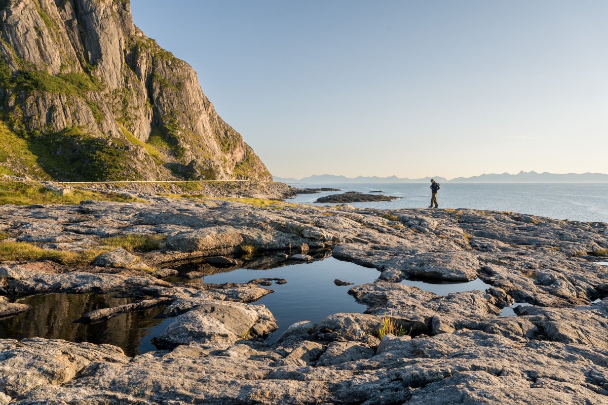
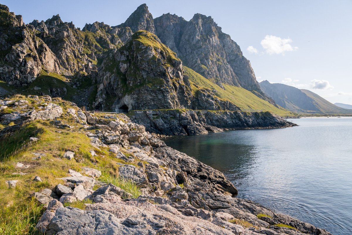
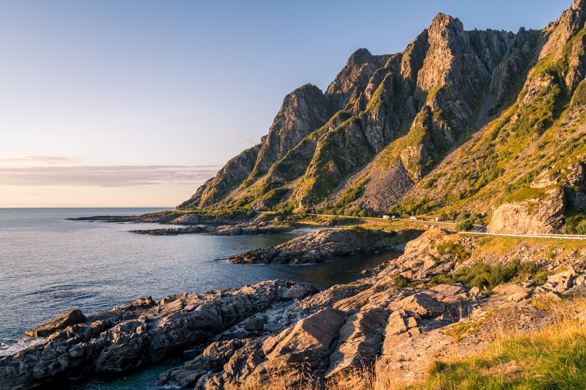
Bukkekjerka
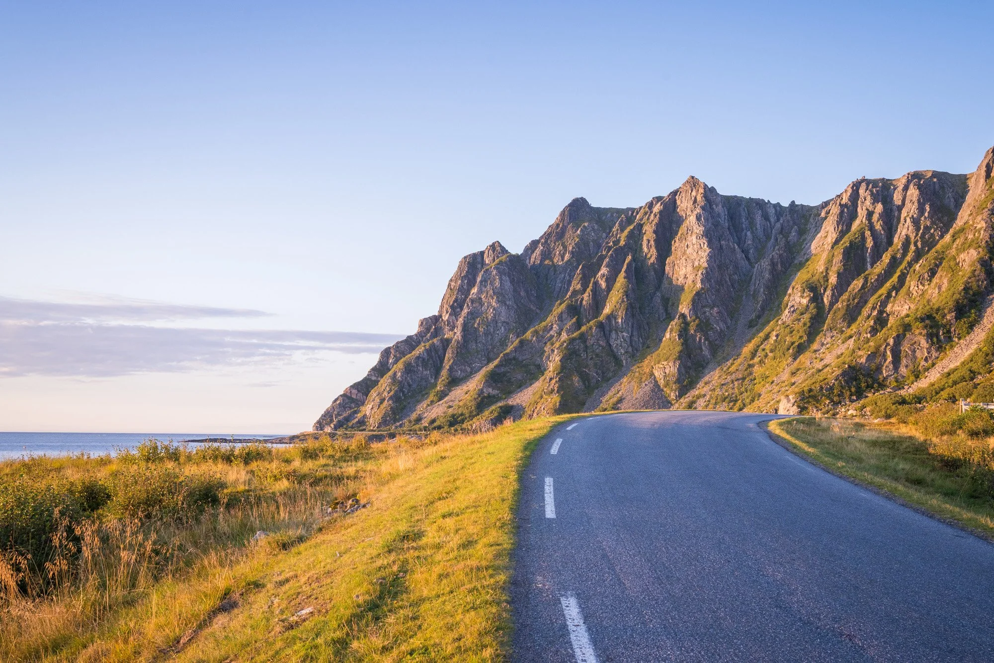
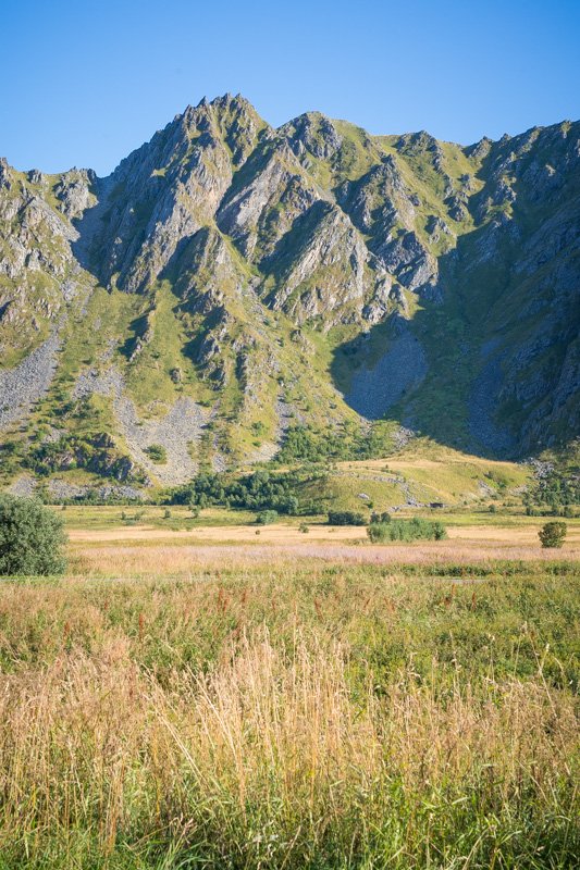
Before long, the flat area is gone and mountains reach down to the sea. The Scenic Route squeezes itself between the rocky shoreline and the steep cliffs. The next couple of kilometres is one of the most scenic areas on the drive, in my opinion.
As the mountains reach out to touch the shore, the coastline fills with more rocky islets and low, craggy headlands.
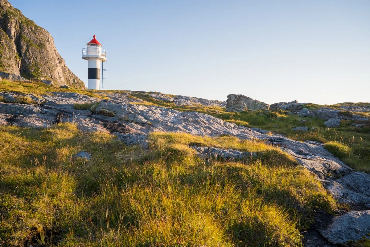
Coming from the north, you will fairly quickly reach Bukkekjerka, a designated rest stop and pullout. As with many of the rest stops on all of Norway’s National Scenic Routes, a unique and custom-designed toilet block has been added as an architectural highlight. It feels odd to be describing toilets as a tourist attraction - but in this case, the toilet block has floor-to-ceiling windows giving anyone inside a wonderful view of the coastline. And from the inside, you can press a button to make the glass opaque, for privacy!
Bukkekjerka
Although it’s great to have good quality toilet facilities, that’s not what we’ve come to see, though! Above the toilet block a low rocky headland that extends out to sea. You can easily walk up and over it for the views – the surface is dotted with rock pools, grasses, a short lighthouse and interesting rock striations. Sunlight in summer is great in the afternoon and evening – the sun sets over the sea and provides beautiful side light all around here. To the north you can see the jagged Toblerone of the seastacks and islands around Bleik, while to the south you can see the mountains of northern Langøya in the distance, across the water.
Walking out onto the headland, you can look back to the shore, where mountains here hulk over you, forming a photogenic gable end. There are plenty of pools and grasses around for foreground. You would need a relatively wide lens for cliff and mountain views here.
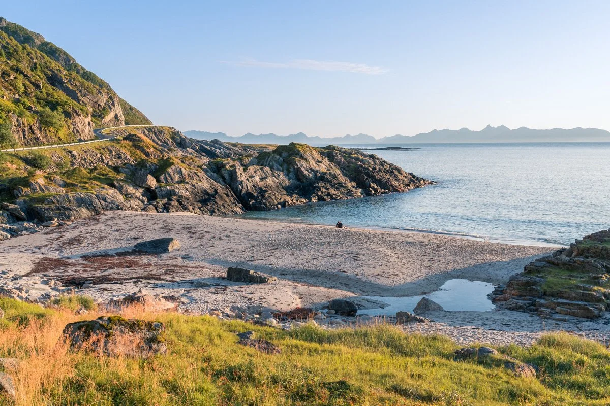
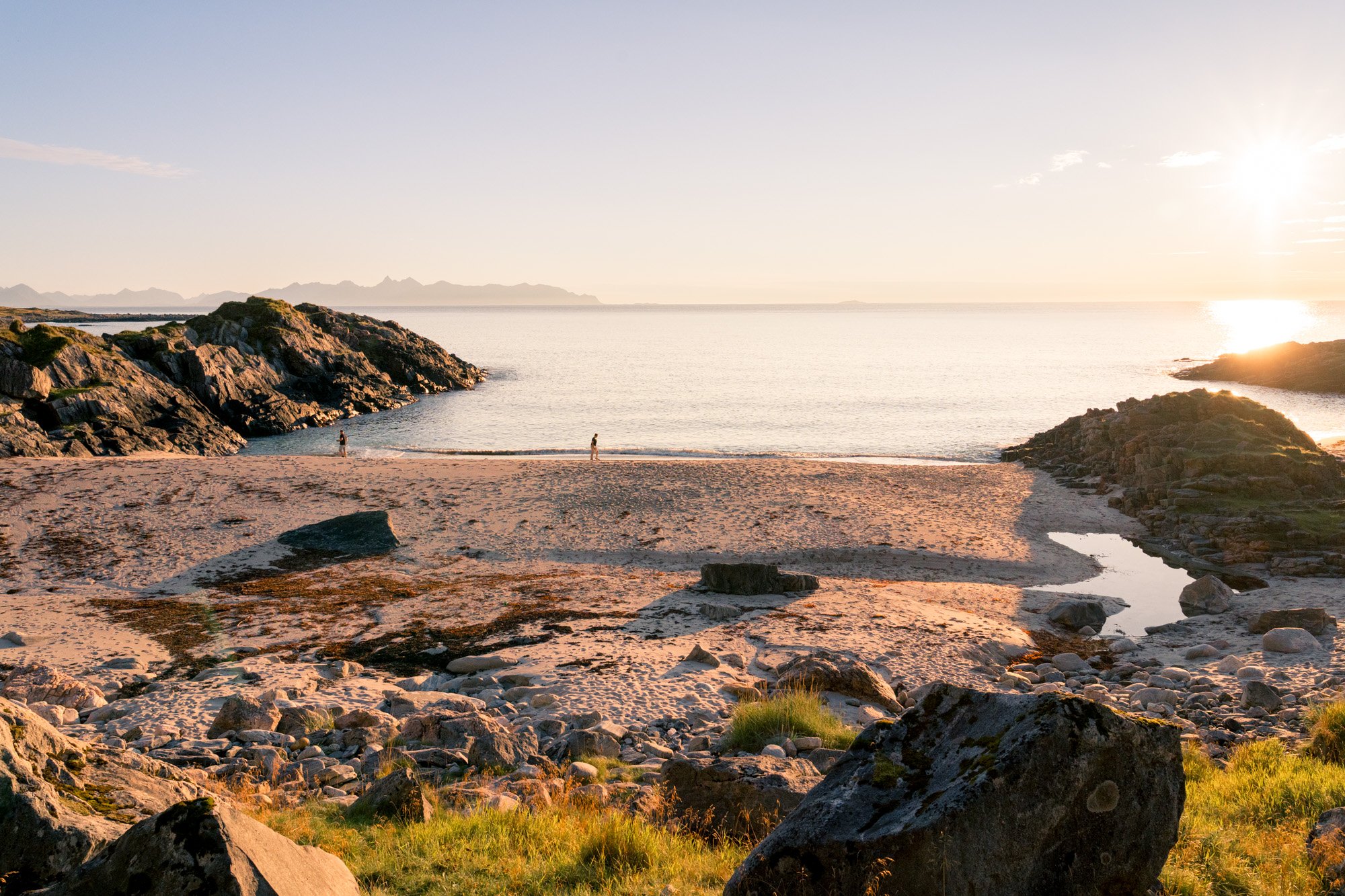
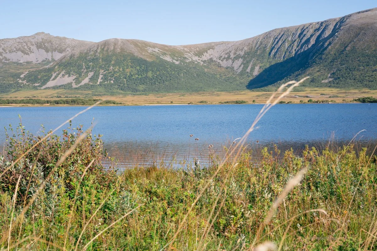
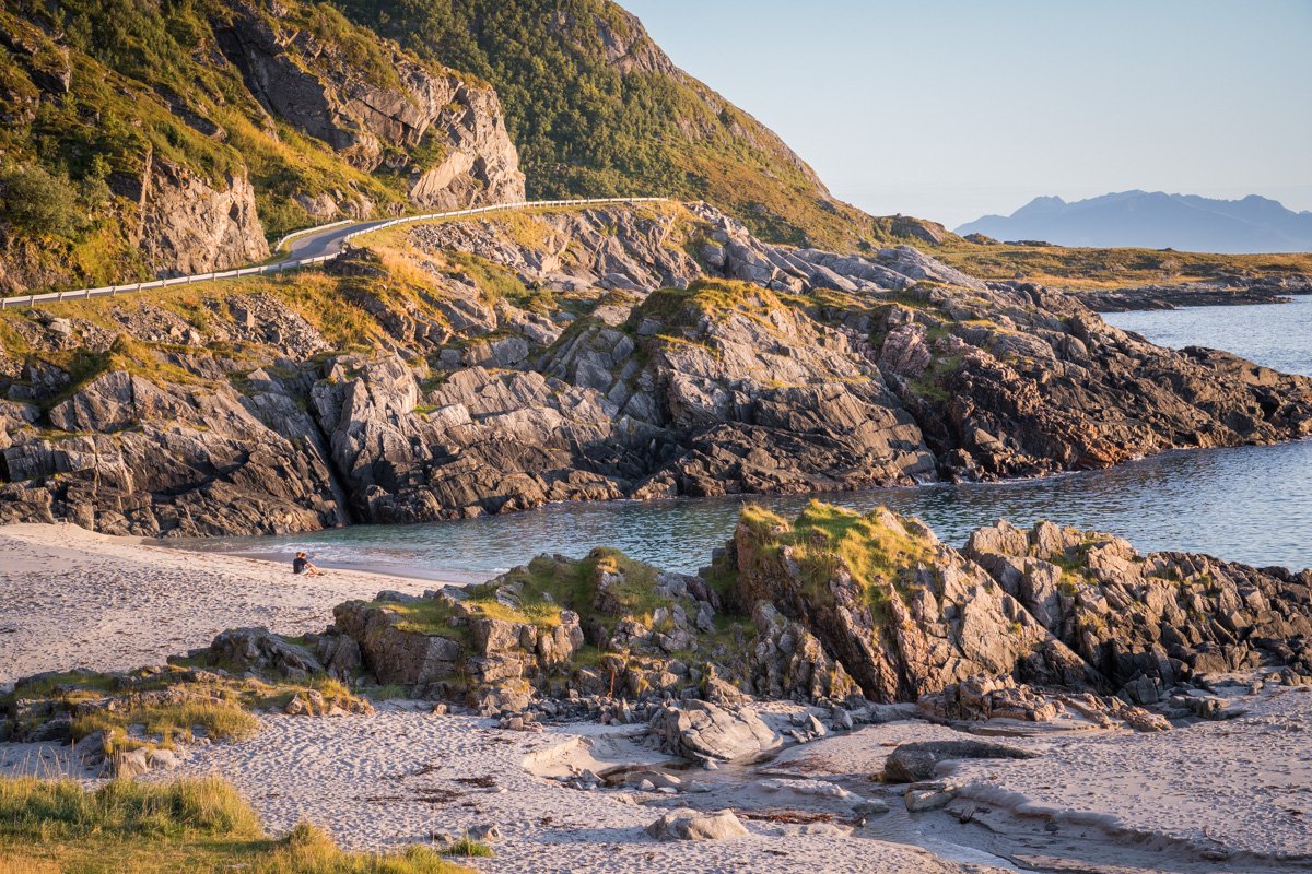
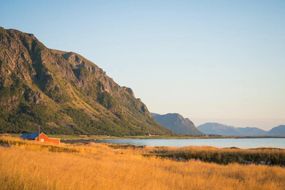
Sandvika
Sandvika is one of my highlights of Andøya.
Leaving Bukkekjerka behind, you will turn a corner where the Scenic Road is squeezed very tightly between waves crashing on the rocky shore and the steep cliffs. Once around the corner, a tiny area of shore opens up between the cliffs and the waves, forming a couple of tiny but beautiful beaches: Sandvika. There are a couple of pullouts here, where you can safely park up to explore. Understandably, this area is very popular with camper vans. The verges lining the road here are lush with greenery and flowers, folded under the vertical cliff faces.
Sandvika
The beaches here are stunners. It’s a short walk down from the slightly elevated road to the level of the water. In the evening the sands glow with a hint of pink, while the clear sea is a glorious turquoise. Black rocks tumble down to the shore, dividing the coastline into separate mini-beaches and framing the views beautifully. The beaches here in September were not deserted, but certainly not crowded, with only a few people dotted around on the sand or around the campervans in the pullout. It’s fabulous spot to watch the sunset.
There are endless opportunities here for wonderful compositions – I was disappointed with my attempts, as they really don’t do the area justice. The road curls around the bottoms of the cliffs here, providing a great leading line, while anyone who loves seascapes will be in their element.
The light in afternoon/evening is spectacular, as long as the western horizon is clear of clouds.
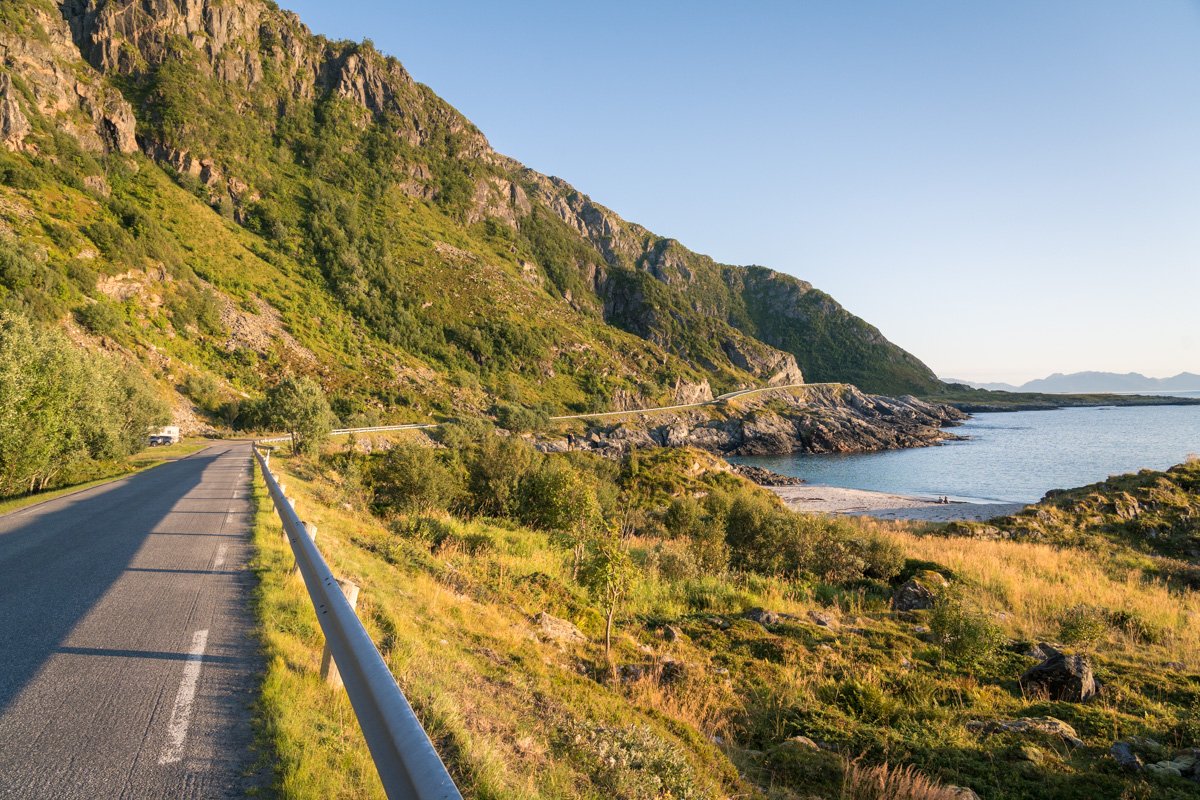
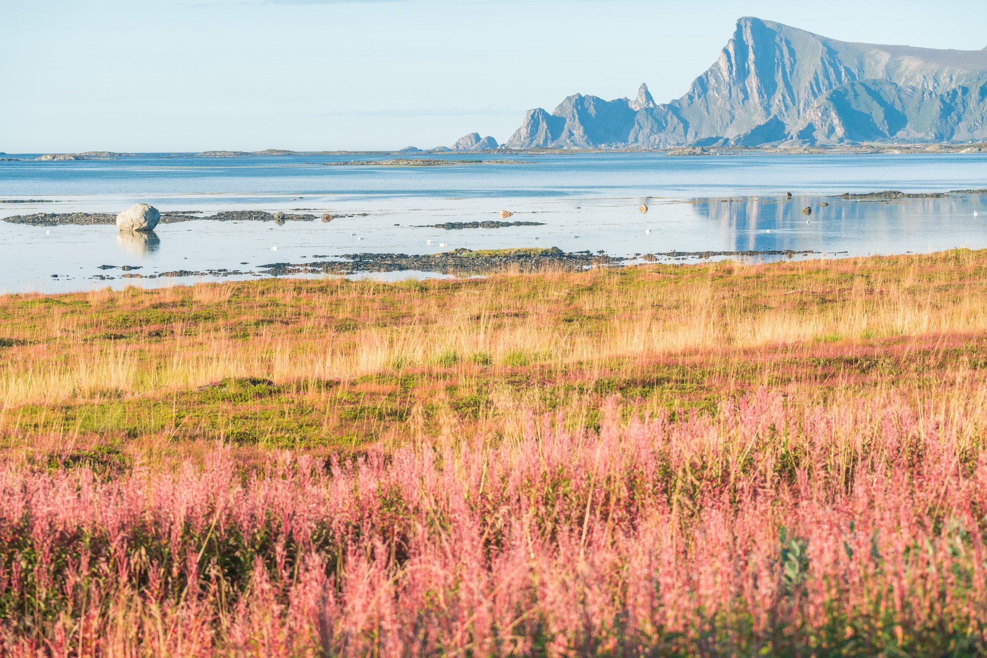
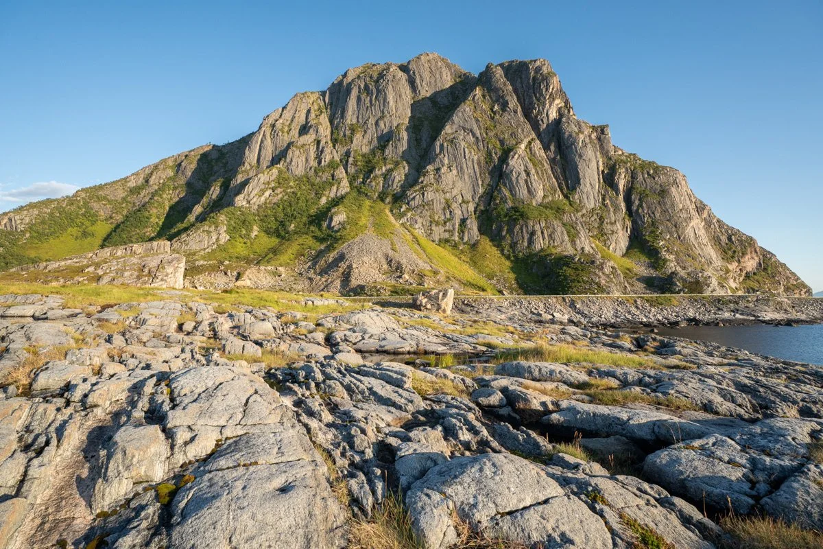
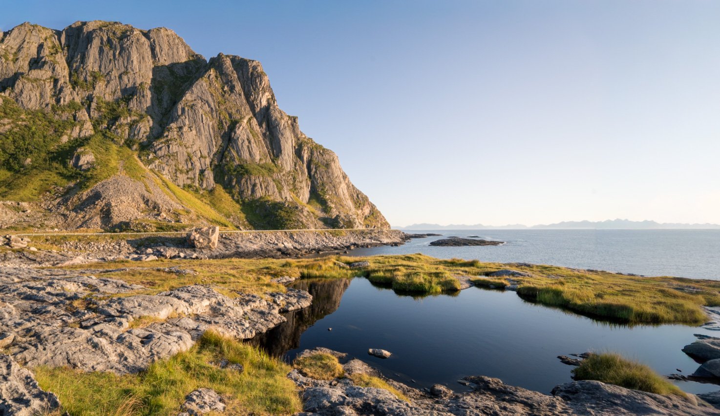
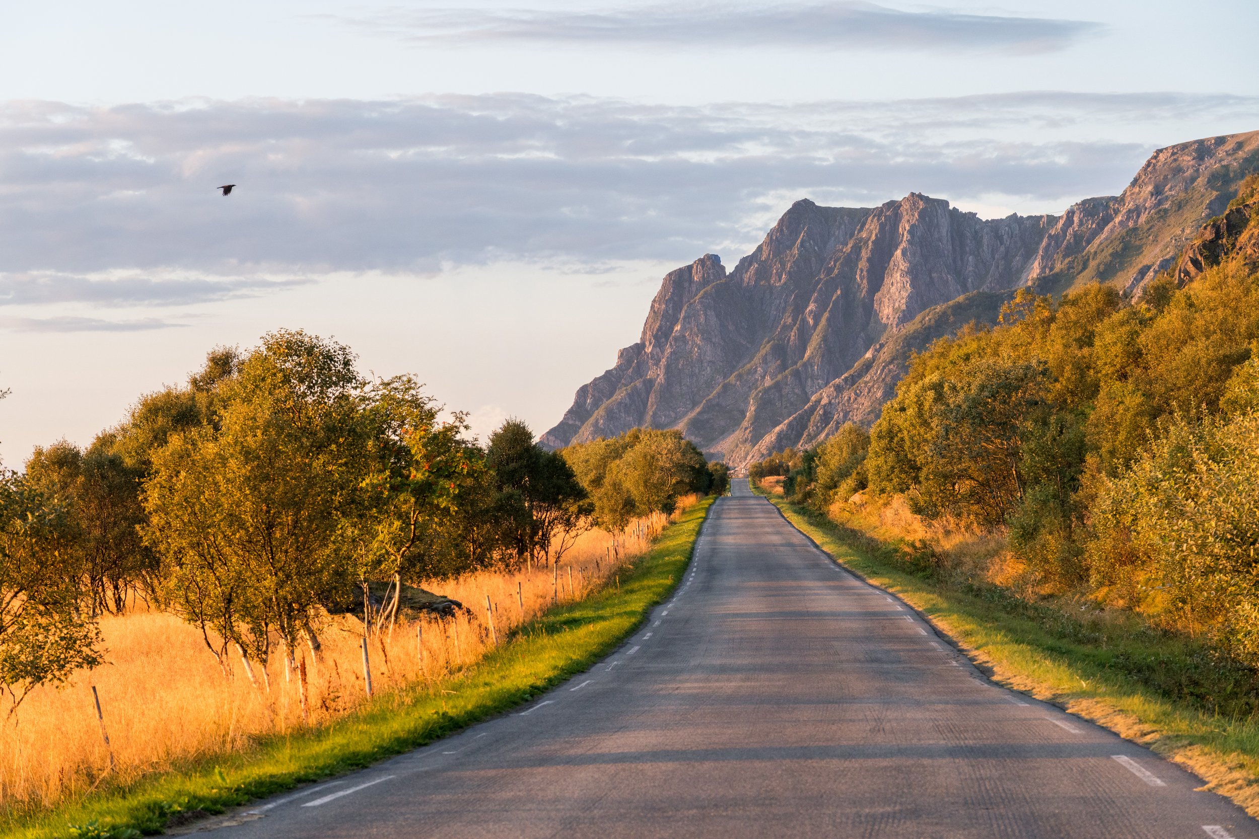
Gårdsfjellet
The road continues southwards, slipping between rocky outcrops on each side and (in summer) lush greenery and boulders covered in lichen. A few hundred metres south of Sandvika is another pullout, on a corner. Definitely stop here (or walk here) – the views back towards Sandvika are stunning. From Sandvika itself it’s hard to appreciate the shapes of the mountains, as they tower above your head. But from here, you can look back towards Sandvika and see clearly the jagged pyramidal shapes looming above the beaches. Plenty of interesting foreground here to help with a nice composition – choose between long grasses and wildflowers, lichens, rocks with interesting striations…
The light here in evening/afternoon is glorious. During the hour or two before sunset, if the horizon is clear of clouds, late summer grasses and wildflowers in the foreground here are backlit by the sun and glow intensely gold.
Gårdsfjellet
Gårdsfjellet to Nøss
Shortly after leaving behind the Gårdsfjellet viewpoint, the road turns around another corner to a different type of view.
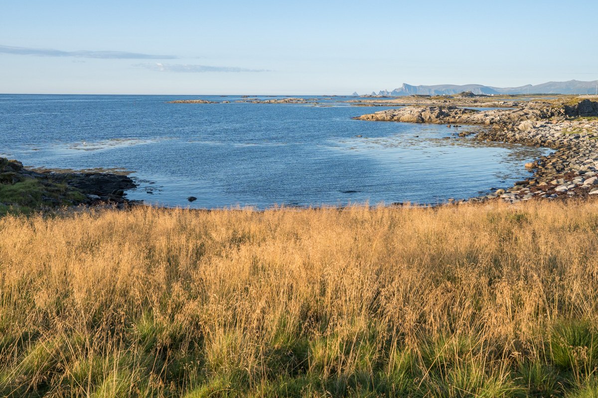
Heaving been elevated above the sea, it down descends gently again. The coast line opens out a little, into a triangular scrap of lush flat meadows. The village of Nøss occupies this area, all meadows and fields, and verges bursting with flowers (in summer). The shore is close by, but flat. No beaches here - the shoreline is a wavy wriggle of black pebbles and boulders, attractive to birds. Above Nøss, in the distance, are more mountains.
In the evening in summer the sunlight pours directly in from the sea, falling on the shoreline, cottages and fields with their mountain backdrop. It makes a lovely scene, in the right light, just as the road descends.
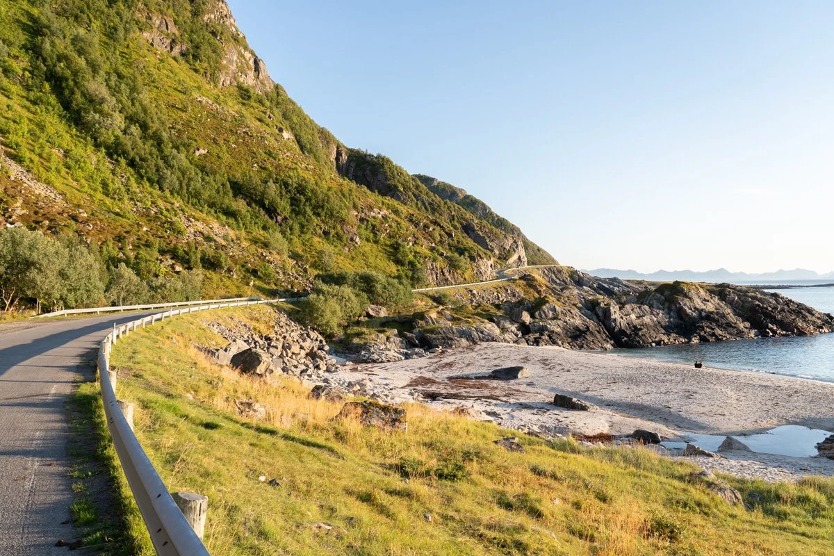
South of Nøss, the Scenic Route passes through a narrow scrap of woodland wedged between the mountains and the sea. The shoreline continues as a series of flat rocky bays rather than beaches. The trees here are quite photogenic – hunched into sheltered corners, or hunkered down to brace themselves against the weather.
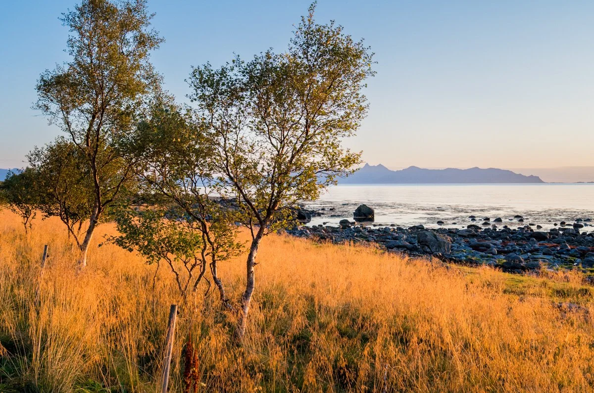
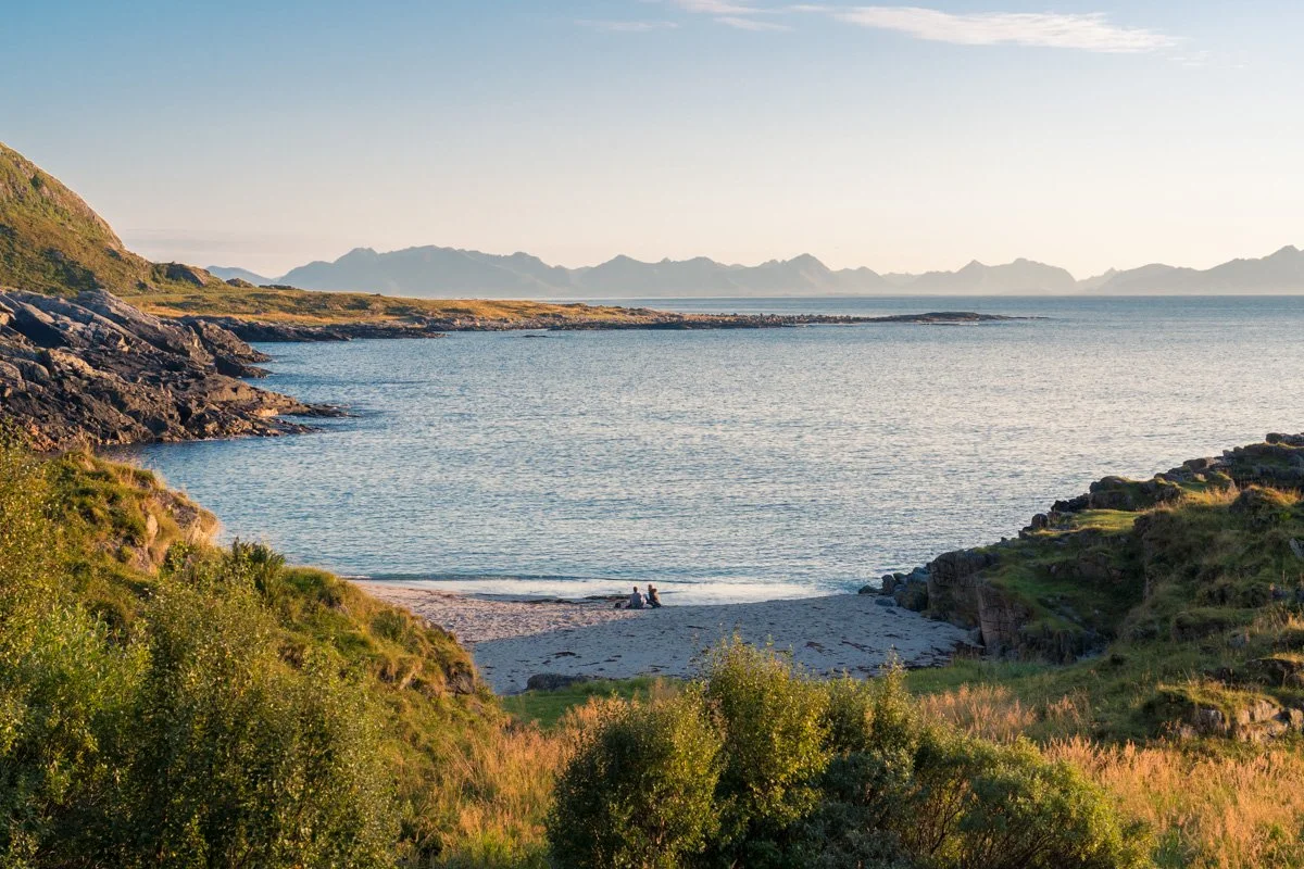
Bø
As the Scenic Route reaches Bø, the scrappy woodland opens into meadows of golden grasses backing the shore, dotted with apple trees and with clear views across the water to the northern tip of Langøya island next door.
At evening here in summer, if the western horizon is free of haze, the sunlight backlights the meadows and golden grasses, creating an absolutely stunning view of glowing gold, fringed with black rocks and tree trunks and a silvery expanse of sea. As before, I was not prepared for this and my compositions certainly don’t do it justice. I had to work quickly though as the light doesn’t stay like this for long. In the right light there are lots of possibilities here for interesting compositions with the strong shapes. If there is no evening light then I think it’s still a nice location, just perhaps not as eyecatching. However, there are still interesting tree shapes and a shore framed in black rocks, along with road and rustic fences forming interesting leading lines.
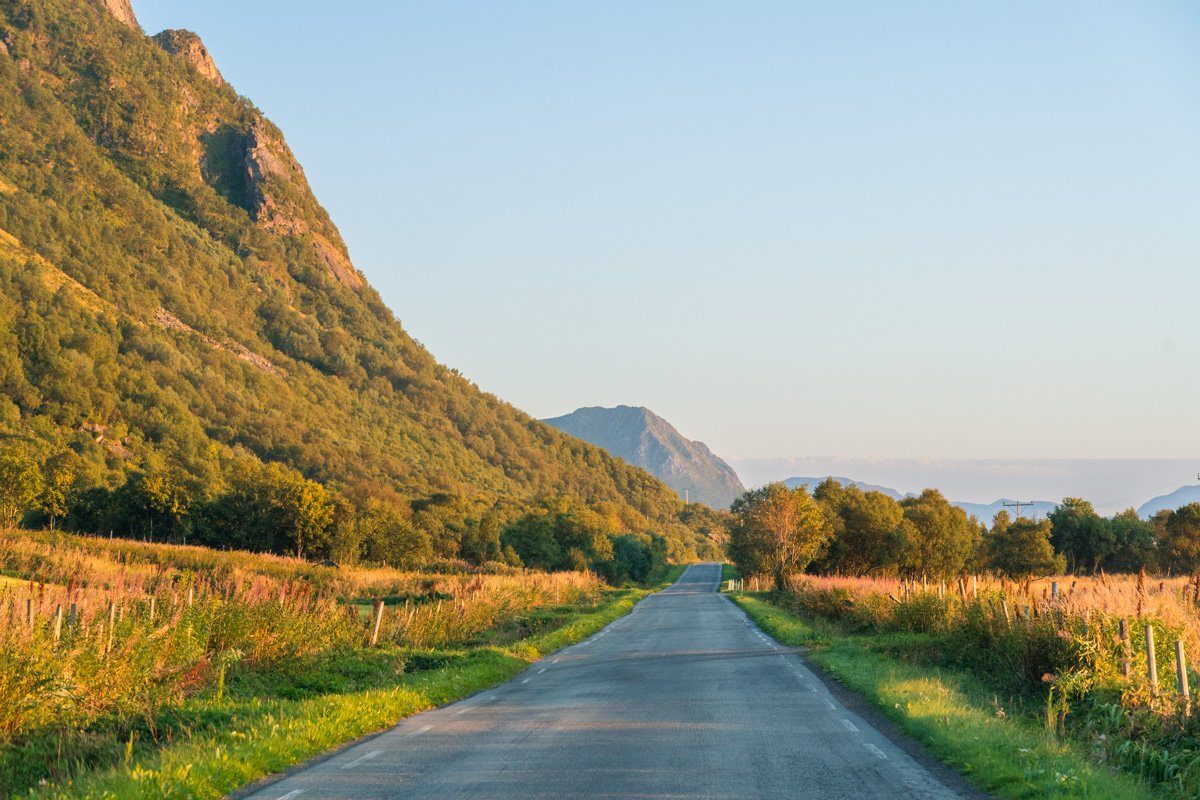
After Bø, the Scenic Route comes to an end; the road turns east and heads inland across lush but flat farmland towards the main (fast) road south to Sortland.
Useful links and sources of information
Here are links that may be helpful:
Plenty of good quality general tourist information is available at Visit Vesteralen and at the Northern Norway Tourist Board
Heart My Backpack and Life In Norway are both wonderful blogs, packed with heaps of useful information if you are planning a trip to Norway
I wasn’t able to take any hikes myself at the time, but The Photo Hikes Blog has some stunning photographs from hikes here and the Visit Vesteralen website also has good hiking information
If you want to explore Norway’s National Tourist Scenic Routes (Nasjonale Touristveger) you can read about all 18 routes here
Many tourist businesses here are very seasonal, and may shut down completely for winter (where “winter” can be very long) In my experience, tools like Google Maps can easily get confused by seasonal variations. So check opening hours and operating dates carefully with the business’s own website/Facebook page/Instagram, and be prepared that there may be some impromptu closures on quiet days. I always carry some snacks with me.